Area Overview for RG2 0HN
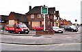
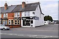
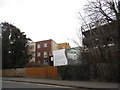
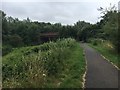
Photos of RG2 0HN
Area Information
RG2 0HN is a compact residential cluster in England, covering just 1.0 hectare and home to 1,790 people. The area’s high population density of 178,890 people per square kilometre suggests a tightly knit community, though its small size means it’s more of a micro-neighbourhood than a sprawling suburb. Situated near Reading, it benefits from proximity to the city’s amenities without the congestion. Daily life here is shaped by its residential focus, with families and professionals making up the majority. The area’s limited footprint means it’s not a place for sprawling developments, but rather a quiet, established pocket of housing. Residents likely rely on nearby transport links and local shops for convenience. While the data doesn’t specify cultural or historical context, its placement within Reading’s broader network hints at accessibility to urban services. For those seeking a compact, community-oriented living space with easy access to the city, RG2 0HN offers a blend of residential simplicity and strategic location.
- Area Type
- Postcode
- Area Size
- 1.0 hectares
- Population
- 1790
- Population Density
- 2882 people/km²
RG2 0HN’s property market is characterised by a low home ownership rate of 36%, suggesting that the majority of housing is rented rather than owner-occupied. The accommodation type is predominantly houses, which may appeal to families or those seeking more space than flats. However, the small area size of 1.0 hectare means the housing stock is limited, and the high population density implies that properties are likely to be close together. This could make the area competitive for buyers, with limited options for expansion or new developments. The low home ownership rate may also indicate a reliance on rental properties, which could affect property values and availability. For buyers, the area’s proximity to Reading’s amenities may be a draw, but the small size means the immediate surroundings are crucial to consider for long-term living needs.
House Prices in RG2 0HN
Showing 35 properties
| Address | Type | Beds | Baths | Last Sale Price | Last Sale Date | |
|---|---|---|---|---|---|---|
| 282 Basingstoke Road, Reading, RG2 0HN | Terraced | 3 | 1 | £310,000 | Oct 2023 | |
| 286 Basingstoke Road, Reading, RG2 0HN | house | - | - | £265,000 | May 2021 | |
| 276 Basingstoke Road, Reading, RG2 0HN | Terraced | 4 | 1 | £245,000 | Jul 2020 | |
| 284 Basingstoke Road, Reading, RG2 0HN | Terraced | 3 | 1 | £245,000 | Mar 2019 | |
| 236 Basingstoke Road, Reading, RG2 0HN | Terraced | 5 | 1 | £345,000 | Nov 2018 | |
| 256 Basingstoke Road, Reading, RG2 0HN | house | 1 | - | £176,000 | Mar 2012 | |
| 280 Basingstoke Road, Reading, RG2 0HN | house | - | - | £162,000 | Apr 2010 | |
| 290 Basingstoke Road, Reading, RG2 0HN | house | 3 | - | £152,000 | Dec 2009 | |
| 278 Basingstoke Road, Reading, RG2 0HN | house | - | - | £165,000 | Dec 2009 | |
| 258 Basingstoke Road, Reading, RG2 0HN | house | 3 | - | £170,000 | Jun 2006 |
Energy Efficiency in RG2 0HN
The lifestyle in RG2 0HN is shaped by its proximity to retail and transport hubs. Residents can access major supermarkets such as Morrisons Whitley, Aldi Whitley, and Makro Reading, which cater to daily shopping needs. The nearby railway stations—Reading, Reading West, and Earley—offer direct links to the city and surrounding areas, facilitating both commuting and leisure travel. While the area’s small size means limited green spaces or parks are not explicitly listed, its integration into Reading’s infrastructure suggests access to urban amenities like cafes, restaurants, and cultural venues. The presence of multiple retail options and transport links implies a convenient, practical lifestyle, ideal for those prioritising accessibility over expansive natural landscapes.
Amenities
Schools
Residents of RG2 0HN have access to a range of educational institutions, including primary schools and independent options. The Palmer Primary Academy is a primary school with a 'good' Ofsted rating, offering a solid foundation for younger children. Nearby, George Palmer Primary School also serves the area, though its rating is not specified. For independent education, OneSchool Global Reading Senior Campus and Redlands Education Centre cater to different needs, with the latter listed as an independent institution. The presence of both state and independent schools provides families with choices, whether they prioritise traditional schooling or alternative educational approaches. The mix of school types reflects a diverse educational landscape, though the data does not indicate student performance or availability of specialist programmes. Parents should consider proximity to these schools when evaluating the area for family living.
| Rank | School | Type | Entry gender | Ages |
|---|
Explore more schools in this area
Go to Schools tabDemographics
The population of RG2 0HN skews towards adults aged 30–64, with a median age of 47. This suggests a community of middle-aged residents, likely including families and professionals. Home ownership is low at 36%, indicating that a significant portion of the housing stock is rented out, which may influence the local property market dynamics. The predominant accommodation type is houses, though the exact distribution of household types—such as single-person or multi-generational homes—is not specified. The area’s predominant ethnic group is White, though no further breakdown of diversity is provided. With a population density of nearly 180,000 per square kilometre, the area is densely populated, which may affect local infrastructure demands. The data does not mention deprivation levels, but the high population density and low home ownership suggest a mix of socioeconomic profiles, with potential implications for public services and community resources.
Household Size
Accommodation Type
Tenure
Ethnic Group
Religion
Household Composition
Age
Household Deprivation
NS-SEC
Explore more demographic insights in this area
Go to Demographics tabPlanning
Planning Constraints
- Flood RiskPremium
- Ramsar Wetland SitesPremium
- Area of Outstanding Natural BeautyPremium
- Protected Nature ReservePremium
- Protected WoodlandPremium