Area Overview for RG2 0EJ
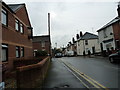
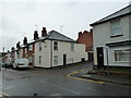
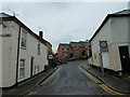
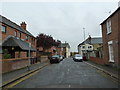
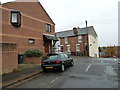
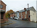
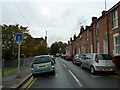
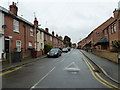
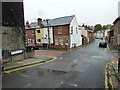
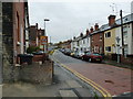
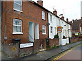
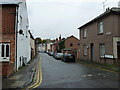
Photos of RG2 0EJ
Area Information
Living in RG2 0EJ offers a compact, residential experience in a small cluster of homes. The area covers 1,114 square metres and is home to 1,283 residents, creating a densely populated yet intimate community. With a median age of 47, the population skews towards adults aged 30–64, suggesting a stable, established demographic. The area’s proximity to retail hubs like Tesco Reading and Makro Reading, along with multiple railway stations including Reading and Earley, ensures practical connectivity for daily life. While the high population density of 1,152,000 people per square kilometre may feel crowded, the small size of the postcode fosters a sense of familiarity. Residents benefit from low crime rates and minimal environmental risks, such as flood or protected land constraints. For those seeking a quiet, well-served residential area with access to essential services, RG2 0EJ provides a balance of convenience and community.
- Area Type
- Postcode
- Area Size
- 1114 m²
- Population
- 1283
- Population Density
- 13559 people/km²
The property market in RG2 0EJ is characterised by a low home ownership rate of 33%, suggesting a rental market dominates. Despite this, the area is primarily composed of houses, which is notable for a small postcode. This mix implies limited housing stock, with properties likely catering to families or long-term renters. The compact size of the area means buyers may find competition for available homes, particularly given the proximity to amenities like Reading’s rail network and retail centres. For those seeking owner-occupied properties, the low ownership rate could indicate fewer opportunities, though the presence of houses may appeal to those prioritising space. The area’s small footprint also means its immediate surroundings are critical for property availability.
House Prices in RG2 0EJ
Showing 1 properties
| Address | Type | Beds | Baths | Last Sale Price | Last Sale Date | |
|---|---|---|---|---|---|---|
| Prospect Cottage, Whitley Street, Reading, RG2 0EJ | house | - | - | £235,000 | Jul 2002 |
Energy Efficiency in RG2 0EJ
Residents of RG2 0EJ enjoy proximity to essential amenities. The area’s retail options include major stores like Tesco Reading and Makro Reading, offering shopping convenience. Rail access via stations such as Reading and Earley ensures easy travel to nearby towns and cities. While the data does not mention parks or leisure facilities, the presence of multiple retail and transport hubs suggests a practical, service-oriented lifestyle. The compact nature of the postcode means amenities are within walking or short driving distance, contributing to a convenient, efficient daily routine.
Amenities
Schools
Residents of RG2 0EJ have access to three primary schools: Christ Church Church of England Primary School, New Christ Church Church of England (VA) Primary School, and New Christ Church Church of England Primary School, which holds an Ofsted rating of ‘good’. The concentration of primary schools suggests the area is well-served for families with young children. All schools are faith-based, reflecting the local demographic. The presence of a ‘good’-rated school adds value for parents prioritising quality education. However, the absence of secondary schools in the data means families may need to look further afield for older children’s schooling. The variety of primary options, though, ensures multiple choices for early education.
| Rank | School | Type | Entry gender | Ages |
|---|
Explore more schools in this area
Go to Schools tabDemographics
RG2 0EJ has a median age of 47, with the most common age group being adults aged 30–64. This suggests a mature, settled population, likely with established careers and families. Home ownership here is relatively low at 33%, indicating a higher proportion of rental properties. The area’s accommodation is predominantly houses, which is unusual given the high population density of 1,152,000 people per square kilometre. The predominant ethnic group is White, though no specific data on diversity or deprivation is provided. The high density may impact living space per person but aligns with the small, clustered nature of the postcode. For buyers, this demographic profile implies a community focused on stability, with a mix of owner-occupied and rented homes.
Household Size
Accommodation Type
Tenure
Ethnic Group
Religion
Household Composition
Age
Household Deprivation
NS-SEC
Explore more demographic insights in this area
Go to Demographics tabPlanning
Planning Constraints
- Flood RiskPremium
- Ramsar Wetland SitesPremium
- Area of Outstanding Natural BeautyPremium
- Protected Nature ReservePremium
- Protected WoodlandPremium