Area Overview for RG2 0DT
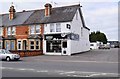
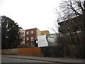
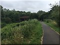
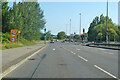
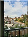
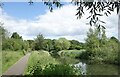
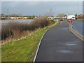
Photos of RG2 0DT

Area Information
RG2 0DT is a compact residential postcode in England, covering 5,238 square metres and home to 1,790 residents. Its high population density—341,711 people per square kilometre—reflects a tightly packed community, likely centred around local amenities and transport links. The area’s small size means residents are close to essential services, though space is limited. Living here offers proximity to schools, retail, and rail networks, making it practical for families and commuters. The median age of 47 suggests a mature population, with most residents aged 30–64, indicating a stable, established community. While the area is small, its mix of housing and infrastructure supports daily life, though buyers should consider the limited land area when assessing long-term needs.
- Area Type
- Postcode
- Area Size
- 5238 m²
- Population
- 1790
- Population Density
- 2882 people/km²
RG2 0DT is a small area with a housing stock primarily composed of houses. However, only 36% of residents are homeowners, indicating a rental market dominates. This suggests limited availability of owner-occupied properties, which could make the area competitive for buyers. The compact size of the postcode means the housing stock is likely limited to the immediate vicinity, requiring buyers to consider nearby areas for more options. The mix of rental and ownership indicates a balance between long-term residents and those seeking temporary accommodation. Given the high population density, property values may reflect the demand for space within a constrained area.
House Prices in RG2 0DT
Showing 20 properties
| Address | Type | Beds | Baths | Last Sale Price | Last Sale Date | |
|---|---|---|---|---|---|---|
| 1 Shenstone Road, Reading, RG2 0DT | Detached | 3 | 1 | £400,000 | Nov 2025 | |
| 11 Shenstone Road, Reading, RG2 0DT | Semi-detached | 3 | 1 | £385,000 | Aug 2024 | |
| 5 Shenstone Road, Reading, RG2 0DT | Semi-detached | 3 | 1 | £395,000 | Oct 2023 | |
| 10 Shenstone Road, Reading, RG2 0DT | Detached | 3 | 1 | £444,000 | Aug 2023 | |
| 2 Shenstone Road, Reading, RG2 0DT | Retail | 3 | 2 | £365,000 | Dec 2021 | |
| 8 Shenstone Road, Reading, RG2 0DT | house | 3 | - | £435,000 | May 2021 | |
| 13 Shenstone Road, Reading, RG2 0DT | house | - | - | £295,000 | Apr 2021 | |
| 7 Shenstone Road, Reading, RG2 0DT | house | - | - | £375,000 | Dec 2020 | |
| 4 Shenstone Road, Reading, RG2 0DT | Semi-detached | 3 | 1 | £350,000 | Jan 2020 | |
| 6 Shenstone Road, Reading, RG2 0DT | house | - | - | £325,000 | Sep 2015 |
Energy Efficiency in RG2 0DT
Residents of RG2 0DT benefit from nearby amenities, including major retail outlets such as Makro Reading, Tesco Reading, and Morrisons Whitley. These stores provide access to groceries, household goods, and other essentials, supporting daily life. The area’s rail connections—Reading Railway Station, Reading West Railway Station, and Earley Railway Station—offer straightforward commuting options. While the data does not specify parks or leisure facilities, the presence of schools and retail suggests a focus on practicality over expansive recreational spaces. The compact nature of the area means amenities are closely clustered, reducing travel time for errands and social activities.
Amenities
Schools
Residents of RG2 0DT have access to a range of schools, including George Palmer Primary School and The Palmer Primary Academy, both of which cater to younger children. The Palmer Primary Academy holds a 'good' Ofsted rating, offering families a reliable state option. Independent schools such as OneSchool Global Reading Senior Campus and Redlands Education Centre provide alternative educational pathways, appealing to parents seeking private schooling. The presence of both state and independent institutions creates a diverse educational landscape, allowing families to choose between public and private education. However, the exact catchment areas and school performance data beyond Ofsted ratings are not specified.
| Rank | School | Type | Entry gender | Ages |
|---|
Explore more schools in this area
Go to Schools tabDemographics
The population of RG2 0DT is predominantly adults aged 30–64, with a median age of 47. Home ownership is low at 36%, suggesting a significant proportion of residents rent their homes. The area is largely composed of houses, though the exact distribution of household types is unspecified. The predominant ethnic group is White, with no data on other demographics. The high population density—341,711 people per square kilometre—means living spaces are closely packed, which could impact privacy and outdoor space. While this density supports community interaction, it also means resources and services must serve a concentrated population, which can affect local infrastructure pressure.
Household Size
Accommodation Type
Tenure
Ethnic Group
Religion
Household Composition
Age
Household Deprivation
NS-SEC
Explore more demographic insights in this area
Go to Demographics tabPlanning
Planning Constraints
- Flood RiskPremium
- Ramsar Wetland SitesPremium
- Area of Outstanding Natural BeautyPremium
- Protected Nature ReservePremium
- Protected WoodlandPremium