Area Overview for RG2 0DP
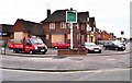
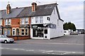
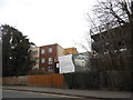
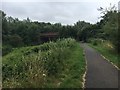
Photos of RG2 0DP
Area Information
RG2 0DP is a small, densely populated residential postcode area in England, covering just 2,518 square metres and home to 1,790 residents. Its compact size means it is a tightly knit community, with a population density of 710,822 people per square kilometre. This area is defined by its proximity to essential services and transport links, making it practical for daily life. The demographic profile suggests a mature population, with a median age of 47 and a majority of residents aged 30–64. This reflects a stable, established community rather than a transient one. Living here offers convenience, with nearby amenities and strong connectivity, though the high density may mean limited green space. The area is not a traditional suburb but a focused cluster of homes, likely integrated into a larger urban or town setting. For buyers, this means a compact, well-served environment, though property availability may be constrained by the small footprint.
- Area Type
- Postcode
- Area Size
- 2518 m²
- Population
- 1790
- Population Density
- 2882 people/km²
The property market in RG2 0DP is characterised by a low home ownership rate of 36%, suggesting that the area is more rental-focused than owner-occupied. This could reflect the small size of the postcode, which may limit the number of available properties, or a higher demand for rental housing from transient or younger residents. The accommodation type is predominantly houses, which is atypical for a high-density area and may indicate a mix of semi-detached or larger properties. Buyers considering this area should be aware of the limited footprint—only 2,518 square metres—meaning competition for properties may be fierce, and availability could be restricted. The immediate surroundings may offer more options, but proximity to amenities and transport links may offset the need for larger living spaces. For those seeking a home, the area’s compact nature demands careful consideration of both property type and location within the broader region.
House Prices in RG2 0DP
Showing 14 properties
| Address | Type | Beds | Baths | Last Sale Price | Last Sale Date | |
|---|---|---|---|---|---|---|
| 365 Elgar Road South, Reading, RG2 0DP | house | - | - | £5,911,197 | Dec 2024 | |
| 361 Elgar Road South, Reading, RG2 0DP | Terraced | 3 | 1 | £285,000 | Dec 2020 | |
| 375 Elgar Road South, Reading, RG2 0DP | Terraced | 3 | 1 | £282,000 | Oct 2020 | |
| 371 Elgar Road South, Reading, RG2 0DP | house | 3 | 2 | £285,000 | Jul 2020 | |
| 359 Elgar Road South, Reading, RG2 0DP | Terraced | 3 | 1 | £280,000 | Jan 2019 | |
| 369 Elgar Road South, Reading, RG2 0DP | Terraced | 3 | - | £313,786 | Jun 2017 | |
| 363 Elgar Road South, Reading, RG2 0DP | Terraced | 3 | 1 | £331,500 | Mar 2016 | |
| 357 Elgar Road South, Reading, RG2 0DP | Terraced | 3 | 1 | £179,950 | Apr 2012 | |
| 373 Elgar Road South, Reading, RG2 0DP | Semi-detached | - | - | £176,500 | Aug 2006 | |
| 381 Elgar Road, Reading, RG2 0DP | Terraced | 3 | - | £130,000 | Apr 2006 |
Energy Efficiency in RG2 0DP
Daily life in RG2 0DP is shaped by its proximity to retail, dining, and transport hubs. The area’s nearby amenities include major supermarkets such as Makro Reading, Tesco Reading, and Morrisons Whitley, providing convenience for shopping and household needs. Rail stations like Reading and Earley offer easy access to broader networks, facilitating travel to surrounding regions. While the data does not specify parks or leisure facilities, the presence of multiple retail outlets and transport links suggests a focus on practicality over expansive recreational spaces. The compact nature of the area means residents are likely within walking or short driving distance of essential services, though larger green spaces or cultural venues may require travel to nearby towns. The lifestyle here is defined by accessibility and efficiency, with a balance between urban convenience and the constraints of a small postcode.
Amenities
Schools
Residents of RG2 0DP have access to a range of educational institutions, including primary schools and independent options. The Palmer Primary Academy, a primary school with an Ofsted rating of ‘good’, provides a state-funded option for younger children. Nearby are George Palmer Primary School and The Palmer Primary Academy, both offering primary education. For independent schooling, OneSchool Global Reading Senior Campus and Redlands Education Centre cater to families seeking alternative educational pathways. The presence of both state and independent schools offers flexibility, allowing parents to choose between publicly funded institutions and private alternatives. However, the area’s small size means these schools are likely concentrated in nearby zones, requiring careful planning for commuting. The diversity of school types reflects a community that values educational choice, though the proximity of these institutions may depend on specific locations within the postcode.
| Rank | School | Type | Entry gender | Ages |
|---|
Explore more schools in this area
Go to Schools tabDemographics
The community in RG2 0DP is predominantly composed of adults aged 30–64, with a median age of 47. This suggests a population of working-age individuals and families, likely with established careers and long-term residency. Home ownership is relatively low at 36%, indicating that a majority of residents are likely to be renters, possibly due to the area’s small size and limited housing stock. The accommodation type is primarily houses, which is unusual for a high-density postcode, hinting at a mix of larger properties or detached homes within a constrained space. The predominant ethnic group is White, with no specific data on other demographics provided. The high population density—over 700,000 people per square kilometre—suggests a compact, possibly urbanised environment where proximity to services is prioritised over space. This density may influence daily life, with limited private outdoor areas but easy access to shared amenities.
Household Size
Accommodation Type
Tenure
Ethnic Group
Religion
Household Composition
Age
Household Deprivation
NS-SEC
Explore more demographic insights in this area
Go to Demographics tabPlanning
Planning Constraints
- Flood RiskPremium
- Ramsar Wetland SitesPremium
- Area of Outstanding Natural BeautyPremium
- Protected Nature ReservePremium
- Protected WoodlandPremium