Area Overview for RG2 0AP
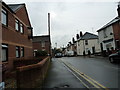
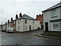
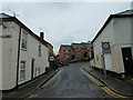
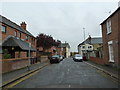
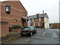
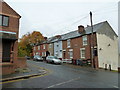
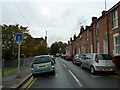
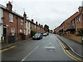
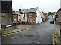
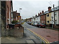
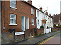
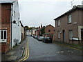
Photos of RG2 0AP
Area Information
RG2 0AP is a compact residential postcode in England, covering just 6696 square metres and home to 1283 residents. Its high population density of 191,595 people per square kilometre reflects a tightly knit community, though the area remains small enough to feel intimate. The postcode includes a mix of housing types, with a focus on family homes. Proximity to Reading’s rail network and major retail outlets like Tesco and Makro makes daily life convenient, while the surrounding area offers access to primary schools with good Ofsted ratings. The population skews towards adults aged 30–64, suggesting a mature, stable demographic. Despite its size, RG2 0AP is well-connected, with multiple railway stations within reach, facilitating travel to nearby towns and cities. The area’s safety profile is strong, with low crime risk and minimal environmental hazards. For those seeking a balance between urban accessibility and a sense of community, RG2 0AP presents a compact, functional living environment.
- Area Type
- Postcode
- Area Size
- 6696 m²
- Population
- 1283
- Population Density
- 13559 people/km²
The property market in RG2 0AP is defined by its small size and focus on houses, with 33% of homes owned by residents. This suggests a mix of owner-occupied and rental properties, though the exact balance is unclear. The area’s compact nature means housing stock is limited, potentially making it a competitive market for buyers. The prevalence of houses, rather than flats or apartments, aligns with a family-oriented demographic. For those considering the area, the small postcode size means properties are likely to be in close proximity to amenities like schools and rail links. However, the limited number of homes may restrict options for buyers seeking specific features or larger properties. The market’s character is shaped by its proximity to Reading’s infrastructure, offering a blend of residential living and urban connectivity.
House Prices in RG2 0AP
Showing 35 properties
| Address | Type | Beds | Baths | Last Sale Price | Last Sale Date | |
|---|---|---|---|---|---|---|
| Flat 5, 2 Aveley Walk, Reading, RG2 0AP | Flat | - | - | - | - | |
| Flat 8, 2 Aveley Walk, Reading, RG2 0AP | Maisonette | - | - | - | - | |
| Flat 9, 2 Aveley Walk, Reading, RG2 0AP | Flat | - | - | - | - | |
| Flat 1, 2 Aveley Walk, Reading, RG2 0AP | Flat | - | - | - | - | |
| Flat 2, 2 Aveley Walk, Reading, RG2 0AP | Maisonette | - | - | - | - | |
| Flat 1, 3 Aveley Walk, Reading, RG2 0AP | Maisonette | - | - | - | - | |
| Flat 3, 3 Aveley Walk, Reading, RG2 0AP | Flat | 3 | 1 | - | - | |
| Flat 2, 3 Aveley Walk, Reading, RG2 0AP | Flat | - | - | - | - | |
| Flat 6, 3 Aveley Walk, Reading, RG2 0AP | Flat | - | - | - | - | |
| Flat 8, 3 Aveley Walk, Reading, RG2 0AP | Maisonette | - | - | - | - |
Energy Efficiency in RG2 0AP
Residents of RG2 0AP benefit from nearby retail and transport hubs, with major stores like Tesco Reading, Makro Reading, and Iceland Reading within practical reach. These shops provide convenience for daily shopping, reducing the need for long journeys. The area’s rail network, with stations such as Reading Railway Station, ensures easy access to urban centres and commuter routes. While the data does not mention parks or leisure facilities, the proximity to Reading suggests opportunities for recreation in the broader region. The combination of retail amenities and transport links creates a lifestyle that balances local convenience with regional connectivity. This makes RG2 0AP suitable for those who value accessibility without sacrificing the charm of a smaller residential area.
Amenities
Schools
Residents of RG2 0AP have access to three primary schools, all affiliated with the Church of England. These include Christ Church Church of England Primary School, New Christ Church Church of England (VA) Primary School, and New Christ Church Church of England Primary School, which holds an Ofsted rating of ‘good’. The presence of multiple primary schools within the area provides families with choices, though all are faith-based institutions. The ‘good’ rating at one school indicates a solid standard of education, which could be a key consideration for parents. The concentration of primary schools suggests the area is well-served for early education, though secondary school options are not detailed in the data. Families prioritising religious schooling may find this cluster of schools particularly appealing.
| Rank | School | Type | Entry gender | Ages |
|---|
Explore more schools in this area
Go to Schools tabDemographics
The population of RG2 0AP has a median age of 47, with the majority of residents falling within the 30–64 age range. This suggests a community of established adults, likely with families, contributing to a stable and mature local environment. Home ownership in the area is relatively low at 33%, indicating a higher proportion of rental properties compared to owner-occupied homes. The predominant accommodation type is houses, which aligns with the area’s residential character. The ethnic composition is largely White, with no specific data provided on other groups. This demographic profile implies a cohesive community with limited diversity in terms of cultural backgrounds. The low home ownership rate may affect property market dynamics, with potential implications for long-term investment or housing stability.
Household Size
Accommodation Type
Tenure
Ethnic Group
Religion
Household Composition
Age
Household Deprivation
NS-SEC
Explore more demographic insights in this area
Go to Demographics tabPlanning
Planning Constraints
- Flood RiskPremium
- Ramsar Wetland SitesPremium
- Area of Outstanding Natural BeautyPremium
- Protected Nature ReservePremium
- Protected WoodlandPremium