Area Overview for RG19 9AU
Photos of RG19 9AU


Area Information
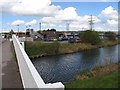
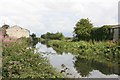
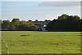
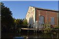
RG19 9AU is a small, tightly knit residential postcode in West Berkshire, England, with a population of 2,855 and a population density of 265 people per square kilometre. It sits within the historic town of Thatcham, a place with deep roots stretching back to prehistoric times. The area is characterised by its compact nature, with homes predominantly being houses rather than flats, reflecting a traditional, low-density residential pattern. Thatcham itself is notable for its ancient origins, with evidence of continuous habitation since the Mesolithic era and a Saxon church dating to around 675 AD. Daily life here is shaped by its rural setting, with easy access to nearby towns like Newbury and the M4 motorway. The community is largely composed of adults aged 30–64, with a median age of 47, suggesting a stable, mature demographic. While the area lacks large-scale urban amenities, its proximity to rail stations and retail outlets like Sainsburys and Waitrose offers practical convenience. For buyers, RG19 9AU presents a blend of historical charm and modern essentials, though its small size means housing stock is limited.
- Area Type
- Postcode
- Area Size
- Not available
- Population
- 2855
- Population Density
- 265 people/km²
RG19 9AU is primarily an owner-occupied area, with 75% of properties in private hands. The accommodation type is predominantly houses, which is typical of rural and semi-rural postcodes in England. This suggests a housing stock that is largely traditional, with limited availability of flats or modern apartments. The small size of the postcode means the property market is niche, with limited scope for expansion or new builds. For buyers, this implies that properties here are likely to be older, with potential for renovation or adaptation. The high home ownership rate also indicates a stable market with fewer rental properties, which may be a consideration for those seeking investment opportunities. However, the area’s proximity to Thatcham and nearby towns like Newbury could offer additional options for those willing to look beyond the immediate postcode.
House Prices in RG19 9AU
No properties found in this postcode.
Energy Efficiency in RG19 9AU
The lifestyle in RG19 9AU is shaped by its proximity to practical amenities, including five rail stations such as Thatcham Railway Station and Midgham Railway Station. These stations provide access to nearby towns and employment hubs. Retail options are well-served by stores like Co-op Thatcham, Sainsburys Thatcham, and Waitrose Thatcham, offering a range of shopping and dining choices. While the area lacks detailed data on parks or leisure facilities, its historical setting in Thatcham suggests potential for cultural or heritage activities. The compact nature of the postcode means amenities are closely clustered, enhancing convenience for residents. However, the absence of specific information on leisure options or recreational spaces means the full extent of lifestyle opportunities remains unquantified.
Amenities
Schools
The only named school near RG19 9AU is The Reintegration Service, which is categorised as an “other” institution rather than a primary or secondary school. This lack of formal educational facilities within the postcode suggests that families may need to look to nearby towns like Thatcham or Newbury for schooling options. The absence of data on Ofsted ratings or school types means it is unclear whether the area’s educational provision meets the needs of local children. For families prioritising proximity to schools, this could be a limitation, requiring careful consideration of commuting distances and available transport links. The mix of nearby amenities, such as retail outlets and rail stations, may partially offset this by providing convenience for parents.
| Rank | School | Type | Entry gender | Ages |
|---|---|---|---|---|
| 1 | The Reintegration Service | other | N/A | N/A |
Explore more schools in this area
Go to Schools tabDemographics
The population of RG19 9AU is predominantly adults aged 30–64, with a median age of 47. This suggests a community of middle-aged residents, many of whom may be settled in long-term homes. Home ownership is high, with 75% of properties owner-occupied, and the majority of accommodation is houses rather than flats. The predominant ethnic group is White, reflecting a homogenous demographic profile. The absence of specific data on deprivation or diversity means the area’s social fabric is not fully quantified, but the high home ownership rate and mature age profile imply a stable, low-turnover community. This demographic structure may influence local services and amenities, which are tailored to the needs of established residents rather than transient populations. The area’s small size and traditional housing stock also suggest limited scope for new developments or demographic shifts.
Household Size
Accommodation Type
Tenure
Ethnic Group
Religion
Household Composition
Age
Household Deprivation
NS-SEC
Explore more demographic insights in this area
Go to Demographics tabPlanning
Planning Constraints
- Flood RiskPremium
- Ramsar Wetland SitesPremium
- Area of Outstanding Natural BeautyPremium
- Protected Nature ReservePremium
- Protected WoodlandPremium
- Crime RiskPremium