Area Overview for RG19 9AJ
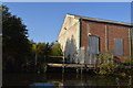
Photos of RG19 9AJ


Area Information
Living in RG19 9AJ means being part of a small, tightly knit residential cluster in West Berkshire, where history and modern convenience intersect. With a population of 2,855 and a density of 265 people per square kilometre, this area offers a quiet, close-knit community feel. Thatcham, the town associated with this postcode, is one of Britain’s oldest continuously inhabited settlements, with evidence of occupation dating back to the Mesolithic era. Residents benefit from proximity to five railway stations, including Thatcham and Newbury Racecourse, and nearby retail hubs like Sainsburys and Waitrose. The area’s compact size means amenities are within practical reach, while its historical significance adds cultural depth. Daily life here balances traditional charm with modern essentials, from broadband rated 93/100 to a network of local shops and transport links. For those seeking a peaceful yet connected lifestyle, RG19 9AJ provides a unique blend of heritage and accessibility.
- Area Type
- Postcode
- Area Size
- Not available
- Population
- 2855
- Population Density
- 265 people/km²
The property market in RG19 9AJ is characterised by high home ownership (75%) and a focus on houses rather than flats. This suggests a community of long-term residents, many of whom may have purchased properties as family homes. The predominance of houses over apartments indicates a preference for private, spacious living, which aligns with the area’s historical and rural character. However, the small size of the postcode area means the housing stock is limited, and buyers may need to look beyond RG19 9AJ itself for more options. The high ownership rate also implies a stable market, with properties likely retaining value due to the area’s low flood risk and proximity to amenities. For those seeking a home, this area offers a blend of traditional architecture and modern living, though availability may be constrained by its compact size.
House Prices in RG19 9AJ
No properties found in this postcode.
Energy Efficiency in RG19 9AJ
Life in RG19 9AJ is supported by nearby amenities that cater to daily needs. The area’s retail options include major supermarkets such as Co-op Thatcham, Sainsburys Thatcham, and Waitrose Thatcham, ensuring easy access to groceries and household essentials. While no parks or leisure facilities are explicitly named in the data, the proximity to railway stations suggests opportunities for weekend excursions or commuting to larger centres. The compact size of the postcode means amenities are within walking or short driving distance, enhancing convenience. The presence of multiple retail outlets and transport links contributes to a practical, low-stress lifestyle, ideal for those valuing accessibility without sacrificing the quiet charm of a small community.
Amenities
Schools
The only school explicitly listed near RG19 9AJ is The Reintegration Service, categorised as an ‘other’ institution. No further details on its Ofsted rating or educational focus are provided, so it is unclear whether it serves as a primary, secondary, or specialist school. Families seeking traditional schooling may need to look beyond the immediate area, as no other schools are mentioned in the data. This lack of nearby educational institutions could be a consideration for parents prioritising convenience. However, the presence of a single school suggests the community may rely on broader local networks or transport links to access wider educational options.
| Rank | School | Type | Entry gender | Ages |
|---|---|---|---|---|
| 1 | The Reintegration Service | other | N/A | N/A |
Explore more schools in this area
Go to Schools tabDemographics
RG19 9AJ’s population skews towards adults aged 30–64, with a median age of 47. This suggests a community of established professionals and families, rather than a younger or retired demographic. Home ownership is high at 75%, reflecting a preference for stable, long-term residency. The area is predominantly composed of houses, not flats, indicating a focus on family-friendly housing. The predominant ethnic group is White, though no data on diversity or deprivation levels is provided. The age profile implies a mature, experienced population, which may influence local services and social dynamics. With no mention of rental properties or transient residents, the area appears to prioritise homeownership over short-term tenancies, shaping a sense of permanence and community cohesion.
Household Size
Accommodation Type
Tenure
Ethnic Group
Religion
Household Composition
Age
Household Deprivation
NS-SEC
Explore more demographic insights in this area
Go to Demographics tabPlanning
Planning Constraints
- Flood RiskPremium
- Ramsar Wetland SitesPremium
- Area of Outstanding Natural BeautyPremium
- Protected Nature ReservePremium
- Protected WoodlandPremium
- Crime RiskPremium