Area Overview for RG19 4YF
Photos of RG19 4YF
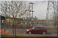
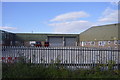
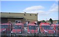
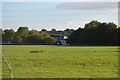
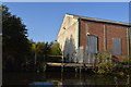


100 photos from this area
Area Information
Key information about the RG19 4YF including its size, population, and administrative classification.
- Area Type
- Postcode
- Area Size
- 2.2 hectares
- Population
- 2855
- Population Density
- 265 people/km²
House Prices in RG19 4YF
50
Properties
£268,189
Average Sold Price
£48,250
Lowest Price
£450,000
Highest Price
Showing 50 properties
| Address | Type | Beds | Baths | Last Sale Price | Last Sale Date | |
|---|---|---|---|---|---|---|
| 46 Wheelers Green Way, Thatcham, RG19 4YF | Semi-detached | 3 | 1 | £377,000 | Nov 2025 | |
| 17 Wheelers Green Way, Thatcham, RG19 4YF | Detached | 2 | 1 | £340,000 | Jul 2025 | |
| 15 Wheelers Green Way, Thatcham, RG19 4YF | Semi-detached | 3 | 2 | £450,000 | Aug 2024 | |
| 47 Wheelers Green Way, Thatcham, RG19 4YF | Detached | 3 | 1 | £340,000 | Feb 2024 | |
| 43 Wheelers Green Way, Thatcham, RG19 4YF | Semi-detached | 3 | 1 | £370,000 | Jan 2024 | |
| 41 Wheelers Green Way, Thatcham, RG19 4YF | Semi-detached | 1 | 1 | £245,000 | Sep 2023 | |
| 54 Wheelers Green Way, Thatcham, RG19 4YF | Detached | 3 | 1 | £430,000 | Nov 2022 | |
| 60 Wheelers Green Way, Thatcham, RG19 4YF | house | 3 | 1 | £365,000 | Nov 2022 | |
| 42 Wheelers Green Way, Thatcham, RG19 4YF | house | - | - | £441,000 | Sep 2022 | |
| 52 Wheelers Green Way, Thatcham, RG19 4YF | Detached | 3 | 1 | £425,000 | Aug 2022 |
Page 1 of 5
Energy Efficiency in RG19 4YF
Amenities
Schools
| Rank | School | Type | Entry gender | Ages |
|---|
Explore more schools in this area
Go to Schools tabDemographics
Household Size
Family (3-5 people)
most common
Accommodation Type
Houses
most common
Tenure
75
majority
Ethnic Group
White
most common
Religion
N/A
most common
Household Composition
N/A
most common
Age
47
median
Adults (30-64 years)
most common
Household Deprivation
N/A
with no deprivation
NS-SEC
40
in Lower managerial occupations
Explore more demographic insights in this area
Go to Demographics tabPlanning
Planning Constraints
- Flood RiskPremium
- Ramsar Wetland SitesPremium
- Area of Outstanding Natural BeautyPremium
- Protected Nature ReservePremium
- Protected WoodlandPremium