Area Overview for RG18 9XG
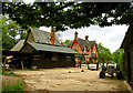
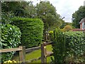
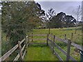
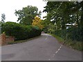
Photos of RG18 9XG

Area Information
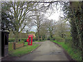
RG18 9XG represents a specific residential cluster located in England, chosen by a population of 2,415 residents. The area maintains a population density of 214 people per square kilometre, which indicates a settled community without overcrowding. This postcode covers a small collection of homes where daily life revolves around local convenience rather than distant city centres. Living in RG18 9XG means experiencing a neighbourhood defined by stability and clear spatial boundaries. The layout supports a quiet pace of life, distinct from the high-density environments found in major urban hubs. Your day-to-day existence here is shaped by proximity to nearby towns without the associated noise or congestion. The area functions as a self-contained pocket of property within the broader RG18 postcode district. You will find that the local environment prioritises straightforward residential living. There is no ambiguity about the area's character; it is a defined zone for families and professionals seeking a specific footprint. The small population ensures that local services remain manageable while still being accessible.
- Area Type
- Postcode
- Area Size
- Not available
- Population
- 2415
- Population Density
- 214 people/km²
The housing market in RG18 9XG is characterised by a distinct lack of rental properties, as 74% of homes are owner-occupied. This statistic indicates that the local market is driven by buyers rather than landlords looking for tenants. The predominant accommodation type is houses, which forms the core of the available property stock. You will find that single-family dwellings dominate the streetscape rather than apartments or flats. This market structure means that new buyers often compete with existing owners who have strong ties to the area. Property prices in RG18 9XG likely reflect the stability of a community where people stay put. The concentration of houses supports a market focused on transactional sales between private individuals. Investors looking for steady rental yields will find this area different from typical tourist or student hubs. If you are purchasing a home here, you are entering a market defined by permanence. The absence of high tenancy rates reduces the likelihood of short-term lease turnover. Your investment potential is tied to the logic of homeownership rather than rental demand fluctuations.
House Prices in RG18 9XG
No properties found in this postcode.
Energy Efficiency in RG18 9XG
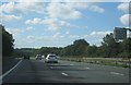
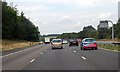
Daily life in RG18 9XG is supported by a network of amenities that sit within practical reach. Residents have five retail options nearby, including the Co-op at Hermitage, Spar, and the Co-op at Thatcham. These shops provide essential groceries and daily necessities without requiring long journeys to town. There are five rail stations accessible to the community, including Thatcham Railway Station, Midgham Railway Station, and Aldermaston Railway Station. These transport hubs offer a clear route for travel if you require occasional trips outside the immediate area. The combination of local shops and rail access creates a lifestyle that balances convenience with the ability to travel when needed. You will find that everyday errands can be completed before leaving the postcode area. Dining and leisure options are not explicitly detailed in the current data, so your entertainment choices will likely rely on the high street and stations identified. This arrangement ensures that residents have access to food and transport without dependency on distant cities.
Amenities
Schools
Families considering RG18 9XG have access to specific educational facilities within their immediate locality. Hermitage Primary School stands as the only primary school listed for the area. This institution holds a 'good' Ofsted rating, a status that denotes effective teaching and satisfactory care by inspectors. The presence of a single primary school named in the data means that options for this age group are specific and limited. You may need to look to neighbouring towns for secondary education options, as none are listed in the current records. The mix of schools available directly suggests a community where children typically begin their formal education in a rated local institution. Parents should verify transport links to Hermitage Primary School to ensure daily commutes are manageable. The 'good' rating provides a factual baseline for educational quality that you can rely upon. While data is limited regarding other phases of education, this primary school serves as the confirmed academic anchor for the RG18 9XG cluster.
| Rank | School | Type | Entry gender | Ages |
|---|
Explore more schools in this area
Go to Schools tabDemographics
The community within RG18 9XG reflects a mature demographic, with a median age of 47 years. Most residents fall into the 30 to 64-year age range, confirming that this is a neighbourhood populated by working adults and established households. Family structures and life stages here tend towards stability rather than transition. Homeownership is a defining feature of the area, with 74% of residents owning their property outright or with a mortgage. This high ownership rate suggests deep roots in the locality and a preference for long-term security over renting. The predominant accommodation type consists of houses, aligning with the needs of the adult population. Demographically, the area is predominantly White, mirroring traditional suburban patterns found across the countryside. Deprivation data is not included in the available records, so observations rely strictly on the age and ownership statistics. You will encounter a community where property values likely reflect this high level of investment. The housing stock supports a population that has settled permanently rather than moving transiently through the state.
Household Size
Accommodation Type
Tenure
Ethnic Group
Religion
Household Composition
Age
Household Deprivation
NS-SEC
Explore more demographic insights in this area
Go to Demographics tabPlanning
Planning Constraints
- Flood RiskPremium
- Ramsar Wetland SitesPremium
- Area of Outstanding Natural BeautyPremium
- Protected Nature ReservePremium
- Protected WoodlandPremium