Area Overview for RG18 9PS
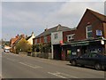
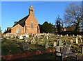
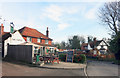
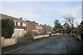
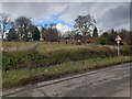
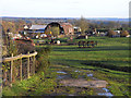
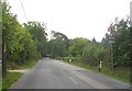
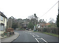
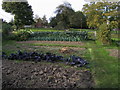
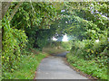
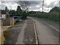
Photos of RG18 9PS
Area Information
RG18 9PS is a specific residential postcode cluster covering 6.0 hectares in England. With a population of 1373, this small area maintains a population density of 726 people per square kilometre. Living in RG18 9PS means being part of a tight-knit community where daily life revolves around local amenities and established neighbours. The compact size of the area fosters an environment where residents know their surroundings intimately. You will find yourself surrounded by established housing stock rather than new developments. This postcode represents a defined slice of the wider RG18 region, offering a sense of familiarity without the scale of a larger town centre. Your daily commutes start from a familiar local cluster, providing a quiet base for your home life. The area functions as a cohesive residential entity where three thousand homes occupy a limited footprint. This concentration creates a distinct character separate from neighbouring postcodes, offering a specific type of suburban living experience.
- Area Type
- Postcode
- Area Size
- 6.0 hectares
- Population
- 1373
- Population Density
- 726 people/km²
The property market in RG18 9PS is overwhelmingly characterised by owner-occupiers. Eighty-three per cent of households own their homes, meaning this is primarily a market for existing residents rather than landlords or short-term renters. Houses form the dominant accommodation type within the 6.0-hectare boundary. This concentration of owner-occupied houses creates a consistent housing stock where most buildings reflect long-term investment decisions. You will encounter a market driven by sellers who are deeply invested in their properties rather than investors looking for quick turnover. This dynamic often results in a more stable property environment compared to areas with high rental turnover. The lack of rental properties suggests that the community values stability and permanence. When you look at homes in RG18 9PS, you are viewing a landscape of private ownership. This structure typically means that maintenance standards are high, as owners have a direct stake in preserving their asset values. The market operates on the principles of a traditional residential community rather than a commercial rental hub.
House Prices in RG18 9PS
Showing 8 properties
| Address | Type | Beds | Baths | Last Sale Price | Last Sale Date | |
|---|---|---|---|---|---|---|
| Bay Cottage, Cold Ash Hill, Cold Ash, Thatcham, RG18 9PS | Cottage | 4 | 2 | £650,000 | Aug 2025 | |
| Cherwell Cottage, Cold Ash Hill, Cold Ash, Thatcham, RG18 9PS | house | - | - | £865,000 | Oct 2019 | |
| Ashgrove, Cold Ash Hill, Cold Ash, Thatcham, RG18 9PS | Bungalow | 3 | 2 | £489,950 | Jul 2019 | |
| Liss, Cold Ash Hill, Cold Ash, Thatcham, RG18 9PS | Detached | 5 | 4 | - | - | |
| The Flat, Castle Inn, Cold Ash Hill, Cold Ash, Thatcham, RG18 9PS | Detached | 4 | 2 | - | - | |
| Woodland Leaves, Cold Ash Hill, Cold Ash, Thatcham, RG18 9PS | house | - | - | - | - | |
| Castle Inn, Cold Ash Hill, Cold Ash, Thatcham, RG18 9PS | restaurant_cafe | - | - | - | - | |
| Ivy Croft, Cold Ash Hill, Cold Ash, Thatcham, RG18 9PS | Detached | - | - | - | - |
Energy Efficiency in RG18 9PS
Living in RG18 9PS places you within practical reach of five retail outlets and five railway stations. Tesco Thatcham, Co-op Thatcham, and Morrisons Daily Thatcham 54 form the core of the local shopping environment. These three supermarkets provide comprehensive options for your daily grocery needs and general shopping requirements. The concentration of retail venues ensures you do not need to travel far for essential goods. Five railway stations, including Thatcham Railway Station and Newbury Railway Station, offer convenient transport links. You can access the Newbury Racecourse Railway Station for specific leisure travel or business connections. These amenities create a self-sufficient lifestyle where daily errands and weekly shopping are locally manageable. The proximity of these specific venues means you can navigate your week without relying on long-distance travel. Your daily life is supported by the immediate availability of food stores and transport hubs. This arrangement provides a convenient balance between local independence and wider regional connectivity.
Amenities
Schools
Families considering schools near RG18 9PS have access to several specific educational options. Cold Ash St Mark's CE Primary School serves as a local primary institution holding a good Ofsted rating. St Finian's Catholic Primary School is another primary option for families in the vicinity, also rated good by Ofsted. Ridge House School operates as an independent school, offering an alternative educational pathway for parents seeking private education. The presence of two state-funded primary schools and one independent institution provides a mix of educational choices within practical reach. Living in this postcode gives you access to both mainstream and private education networks. The good ratings of the state schools indicate a positive standard of education available locally. This combination of school types allows parents to access either a religiously affiliated state school or a private academy. You do not need to travel far to find quality educational facilities for your children.
| Rank | School | Type | Entry gender | Ages |
|---|
Explore more schools in this area
Go to Schools tabDemographics
The community in RG18 9PS is defined by a mature population profile. The median age stands at 47 years, reflecting a demographic dominated by adults aged between 30 and 64 years old. Fittingly, 83% of households own their homes entirely. Households renting or shared ownership make up only a minority of the 1373 residents. The predominant ethnic group is White, which aligns with the established nature of the neighbourhood. Because 83% of residents are homeowners, the area reflects long-term settlements rather than transient populations. This high ownership rate suggests stability and a community invested in the local environment. You will find that the majority of neighbours have resided here for significant periods. The demographic data paints a picture of a established, family-oriented community where residents are likely deeply embedded in local civic life. The age structure indicates a lack of young children or elderly residents as the primary demographic drivers, focusing instead on the working-age adult population.
Household Size
Accommodation Type
Tenure
Ethnic Group
Religion
Household Composition
Age
Household Deprivation
NS-SEC
Explore more demographic insights in this area
Go to Demographics tabPlanning
Planning Constraints
- Flood RiskPremium
- Ramsar Wetland SitesPremium
- Area of Outstanding Natural BeautyPremium
- Protected Nature ReservePremium
- Protected WoodlandPremium