Area Overview for RG18 3BG
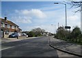
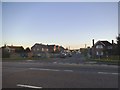
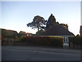
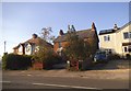
Photos of RG18 3BG


Area Information
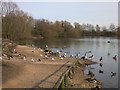
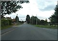
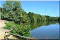
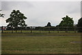
Living in RG18 3BG places you within a small residential cluster characterised by deep historical roots. This postcode covers a population of 1961 people, situated in West Berkshire, South East England. The area identifies itself as part of Thatcham, a civil parish and ancient town that claims to be one of the oldest continuously inhabited settlements in Great Britain. Archaeological evidence suggests occupation dating back to the Mesolithic period, around 8400–7700 BCE, through the Bronze and Iron Ages. You are accessing a location where the Old Bluecoat School, a Grade I-listed building from 1304, stands alongside St Mary's Church, which has origins tracing back to 675 AD. The vicinity once served as the largest settlement by the Domesday Book of 1086 and was the centre of Thatcham Hundred. While Newbury merchants attacked the town following its market rights grant in the 12th century, it retained royal borough status by 1300. Today, the area retains a connection to this administrative and historical legacy without the industrial density of its medieval peak. Residents buy into a legacy of continuous habitation rather than modern urban sprawl, enjoying proximity to sites like the Roman settlement near Quaking Bridge and the Bronze Age cremation cemetery at Hartshill Copse.
- Area Type
- Postcode
- Area Size
- Not available
- Population
- 1961
- Population Density
- 3156 people/km²
The property market in RG18 3BG is defined by a strong preference for residential houses and private ownership. Nearly 69% of residents own their homes outright or with a mortgage, while only a minority rent. This high home ownership rate signals a market where houses are the dominant accommodation type, with very few flats available within this specific postcode cluster. For buyers searching for homes in RG18 3BG, the inventory will likely consist of detached or semi-detached properties rather than urban apartment blocks. The small population size of 1961 limits the sheer volume of transactions compared to larger towns, but it creates a niche market for those seeking a quieter settlement. The historical context of the area, including its status as an ancient town, often accompanies property prices in similar Babworth Historic districts. There are no large-scale rental schemes currently evident in the data for this location. Instead, the market operates on the principle of individual family ownership. This structure means that maintenance and upgrades usually remain the responsibility of the homeowner, not a landlord. You can expect a traditional housing stock that reflects the property norms of West Berkshire and the surrounding South East England region.
House Prices in RG18 3BG
No properties found in this postcode.
Energy Efficiency in RG18 3BG
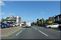
Your daily lifestyle in RG18 3BG benefits from immediate access to essential retail and transport hubs just beyond the residential cluster. Within practical reach, you can visit Tesco Thatcham, Co-op Thatcham, and Morrisons Daily Thatcham 54 for your grocery and shopping requirements. This selection of five retail venues ensures you do not need to travel far for household supplies. For commuters, five rail stations serve the surrounding network, including Thatcham Railway Station, Newbury Racecourse Railway Station, and Newbury Railway Station. These connections anchor your ability to reach broader employment markets in Reading or London. The proximity to these stations makes daily travel manageable without the need for private vehicles for every journey. Beyond commerce and transport, the area is defined by its historical landmarks rather than modern leisure complexes. Key features include the Grade I-listed Old Bluecoat School, St Mary's Church, and archaeological sites at Hartshill Copse. While dining and leisure data are not detailed in the provided statistics, the presence of historic sites suggests a cultural focus for weekend activities. Residents often enjoy walking routes that pass near these ancient monuments, connecting them to the local heritage.
Amenities
Schools
Families considering living in RG18 3BG have access to specific educational facilities nearby. The nearest school listed in the data is Faith Christian School, which operates as an independent institution. This is the only school currently identified in the immediate vicinity of this small postcode area. The independent status of Faith Christian School suggests a private education option, often associated with selective admissions or higher tuition fees. If you are looking for schools near RG18 3BG, this is your primary option based on current records. The absence of a state-funded school in the immediate on-site data means that residents rely on this single independent provider or must commute to larger towns for alternatives. While the school does not have an Ofsted rating listed in the provided information, its classification as an independent school places it outside the local authority's direct leadership. There are no vocational colleges or secondary schools explicitly named in the dataset for this specific zone. Families in this area will need to factor in travel time for their children depending on the specific age group and whether Faith Christian School accommodates their children's needs.
| Rank | School | Type | Entry gender | Ages |
|---|
Explore more schools in this area
Go to Schools tabDemographics
The community within RG18 3BG reflects a mature demographic profile. The median age for residents is 47 years, with the most common age range falling between 30 and 64 years. This indicates a population dominated by adults in their middle years, suggesting a neighbourhood where stability and established careers often define daily life. Home ownership stands at 69%, which is significantly higher than the national average. This high level of ownership implies long-term residents rather than transient tenants, fostering a sense of community continuity. The predominant ethnic group is White, aligning with the broader landscape of many historic English settlements. In terms of physical accommodation, houses form the primary dwelling type for this postcode. You will find few flats or high-density housing options in this specific cluster. The area does not display signs of extreme deprivation based on the available household and ownership data. Instead, the high concentration of owner-occupied homes suggests a stable financial environment for the 1961 residents. The demographic structure supports a quiet, settled lifestyle where families or long-serving professionals create the social fabric of the district.
Household Size
Accommodation Type
Tenure
Ethnic Group
Religion
Household Composition
Age
Household Deprivation
NS-SEC
Explore more demographic insights in this area
Go to Demographics tabPlanning
Planning Constraints
- Flood RiskPremium
- Ramsar Wetland SitesPremium
- Area of Outstanding Natural BeautyPremium
- Protected Nature ReservePremium
- Protected WoodlandPremium