Area Overview for RG18 0TN
Photos of RG18 0TN
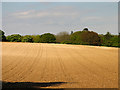
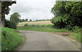

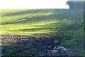
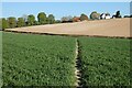
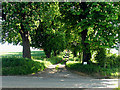
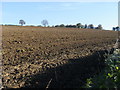
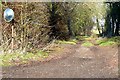
8 photos from this area
Area Information
Key information about the RG18 0TN including its size, population, and administrative classification.
- Area Type
- Postcode
- Area Size
- 2.0 km²
- Population
- 1601
- Population Density
- 47 people/km²
House Prices in RG18 0TN
23
Properties
£637,500
Average Sold Price
£532,500
Lowest Price
£730,000
Highest Price
Showing 23 properties
| Address | Type | Beds | Baths | Last Sale Price | Last Sale Date | |
|---|---|---|---|---|---|---|
| Firtree Farm, Wyld Court Hill, Hampstead Norreys, Thatcham, RG18 0TN | house | 2 | 1 | £730,000 | Jun 2022 | |
| Knapp Cottage, Wyld Court Hill, Hampstead Norreys, Thatcham, RG18 0TN | Detached | 3 | 7 | £650,000 | Jul 2011 | |
| Sarsen Stone Cottage, Wyld Court Hill, Hampstead Norreys, Thatcham, RG18 0TN | Detached | - | - | £532,500 | Jun 2006 | |
| 3 Wyld Court Hill, Hampstead Norreys, Thatcham, RG18 0TN | house | - | - | - | - | |
| 6 Wyld Court Hill, Hampstead Norreys, Thatcham, RG18 0TN | house | - | - | - | - | |
| 8 Wyld Court Hill, Hampstead Norreys, Thatcham, RG18 0TN | house | - | - | - | - | |
| 5 Wyld Court Hill, Hampstead Norreys, Thatcham, RG18 0TN | house | - | - | - | - | |
| 4 Wyld Court Hill, Hampstead Norreys, Thatcham, RG18 0TN | house | 3 | 1 | - | - | |
| 1 Wyld Court Hill, Hampstead Norreys, Thatcham, RG18 0TN | house | - | - | - | - | |
| 7 Wyld Court Hill, Hampstead Norreys, Thatcham, RG18 0TN | house | - | - | - | - |
Page 1 of 3
Energy Efficiency in RG18 0TN
Amenities
Schools
| Rank | School | Type | Entry gender | Ages |
|---|
Explore more schools in this area
Go to Schools tabDemographics
Household Size
Family (3-5 people)
most common
Accommodation Type
Houses
most common
Tenure
53
majority
Ethnic Group
White
most common
Religion
N/A
most common
Household Composition
N/A
most common
Age
47
median
Adults (30-64 years)
most common
Household Deprivation
N/A
with no deprivation
NS-SEC
45
in Lower managerial occupations
Explore more demographic insights in this area
Go to Demographics tabPlanning
Planning Constraints
- Flood RiskPremium
- Ramsar Wetland SitesPremium
- Area of Outstanding Natural BeautyPremium
- Protected Nature ReservePremium
- Protected WoodlandPremium