Area Overview for RG18 0TE
Photos of RG18 0TE
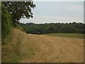
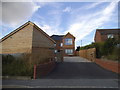
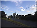
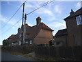
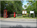
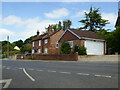
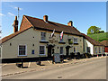
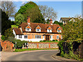
52 photos from this area
Area Information
Key information about the RG18 0TE including its size, population, and administrative classification.
- Area Type
- Postcode
- Area Size
- 14.0 hectares
- Population
- 1601
- Population Density
- 47 people/km²
House Prices in RG18 0TE
25
Properties
£469,627
Average Sold Price
£175,000
Lowest Price
£875,000
Highest Price
Showing 25 properties
| Address | Type | Beds | Baths | Last Sale Price | Last Sale Date | |
|---|---|---|---|---|---|---|
| Tree Tops, Forge Hill, Hampstead Norreys, Thatcham, RG18 0TE | house | 4 | - | £875,000 | Sep 2025 | |
| Pippins, Forge Hill, Hampstead Norreys, Thatcham, RG18 0TE | Bungalow | - | - | £660,000 | Jun 2022 | |
| Green Hill Cottage, Forge Hill, Hampstead Norreys, Thatcham, RG18 0TE | house | - | - | £310,777 | Oct 2019 | |
| 1, Forge Cottages, Forge Hill, Hampstead Norreys, Thatcham, RG18 0TE | house | 3 | 2 | £547,000 | Aug 2019 | |
| Eastridge, Forge Hill, Hampstead Norreys, Thatcham, RG18 0TE | house | - | - | £735,000 | Jan 2019 | |
| Orchard View, Forge Hill, Hampstead Norreys, Thatcham, RG18 0TE | Bungalow | - | - | £735,000 | Aug 2017 | |
| Gate Cottage, Forge Hill, Hampstead Norreys, Thatcham, RG18 0TE | Detached | 4 | 2 | £665,000 | Feb 2015 | |
| Barnes Cottage, Forge Hill, Hampstead Norreys, Thatcham, RG18 0TE | Bungalow | 2 | - | £330,000 | Aug 2012 | |
| Pangmere, Forge Hill, Hampstead Norreys, Thatcham, RG18 0TE | house | - | - | £740,000 | Aug 2011 | |
| The Gables, Forge Hill, Hampstead Norreys, Thatcham, RG18 0TE | house | 3 | - | £340,000 | Dec 2010 |
Page 1 of 3
Energy Efficiency in RG18 0TE
Amenities
Schools
| Rank | School | Type | Entry gender | Ages |
|---|
Explore more schools in this area
Go to Schools tabDemographics
Household Size
Family (3-5 people)
most common
Accommodation Type
Houses
most common
Tenure
53
majority
Ethnic Group
White
most common
Religion
N/A
most common
Household Composition
N/A
most common
Age
47
median
Adults (30-64 years)
most common
Household Deprivation
N/A
with no deprivation
NS-SEC
45
in Lower managerial occupations
Explore more demographic insights in this area
Go to Demographics tabPlanning
Planning Constraints
- Flood RiskPremium
- Ramsar Wetland SitesPremium
- Area of Outstanding Natural BeautyPremium
- Protected Nature ReservePremium
- Protected WoodlandPremium