Area Overview for RG17 9PZ
Photos of RG17 9PZ
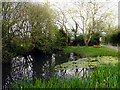

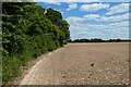
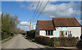
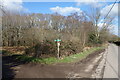
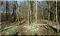

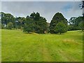
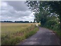
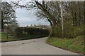
29 photos from this area
Area Information
Key information about the RG17 9PZ including its size, population, and administrative classification.
- Area Type
- Postcode
- Area Size
- 15.3 hectares
- Population
- 2042
- Population Density
- 26 people/km²
House Prices in RG17 9PZ
8
Properties
£638,121
Average Sold Price
£129,223
Lowest Price
£1,522,000
Highest Price
Showing 8 properties
| Address | Type | Beds | Baths | Last Sale Price | Last Sale Date | |
|---|---|---|---|---|---|---|
| Malt Cottage, Road Known As Post Office Road, Upper Green, Inkpen, RG17 9PZ | Detached | - | - | £760,000 | Aug 2017 | |
| Leyfield, Road Known As Post Office Road, Upper Green, Inkpen, RG17 9PZ | Detached | - | - | £500,000 | Feb 2017 | |
| Meadow House, Road Known As Post Office Road, Upper Green, Inkpen, RG17 9PZ | house | 5 | - | £1,522,000 | Aug 2015 | |
| Linton House, Road Known As Post Office Road, Upper Green, Inkpen, RG17 9PZ | Detached | - | - | £730,000 | Apr 2005 | |
| Rolfes Farm House, Road Known As Post Office Road, Upper Green, Inkpen, RG17 9PZ | house | - | - | £129,223 | Mar 1998 | |
| Thyme House, Road Known As Post Office Road, Upper Green, Inkpen, RG17 9PZ | Detached | 4 | 2 | £187,500 | Sep 1997 | |
| Barcot Barn, Road Known As Post Office Road, Upper Green, Inkpen, RG17 9PZ | Detached | 3 | 2 | - | - | |
| Rolfes Farm, Road Known As Post Office Road, Upper Green, Inkpen, RG17 9PZ | Farm | - | - | - | - |
Energy Efficiency in RG17 9PZ
Amenities
Schools
| Rank | School | Type | Entry gender | Ages |
|---|
Explore more schools in this area
Go to Schools tabDemographics
Household Size
Two person
most common
Accommodation Type
Houses
most common
Tenure
67
majority
Ethnic Group
White
most common
Religion
N/A
most common
Household Composition
N/A
most common
Age
47
median
Adults (30-64 years)
most common
Household Deprivation
N/A
with no deprivation
NS-SEC
46
in Lower managerial occupations
Explore more demographic insights in this area
Go to Demographics tabPlanning
Planning Constraints
- Flood RiskPremium
- Ramsar Wetland SitesPremium
- Area of Outstanding Natural BeautyPremium
- Protected Nature ReservePremium
- Protected WoodlandPremium