Area Overview for RG17 9PU
Photos of RG17 9PU
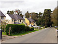
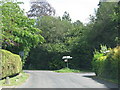


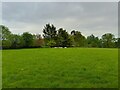


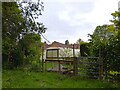
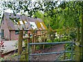

25 photos from this area
Area Information
Key information about the RG17 9PU including its size, population, and administrative classification.
- Area Type
- Postcode
- Area Size
- 12.7 hectares
- Population
- 2042
- Population Density
- 26 people/km²
House Prices in RG17 9PU
15
Properties
£502,214
Average Sold Price
£60,000
Lowest Price
£1,040,000
Highest Price
Showing 15 properties
| Address | Type | Beds | Baths | Last Sale Price | Last Sale Date | |
|---|---|---|---|---|---|---|
| Appletrees, Post Office Road, Inkpen, Hungerford, RG17 9PU | Detached | 5 | 3 | £740,000 | Sep 2023 | |
| The Firs, Post Office Road, Inkpen, Hungerford, RG17 9PU | Detached | - | - | £60,000 | Jun 2019 | |
| Charlwood, Post Office Road, Inkpen, Hungerford, RG17 9PU | Detached | 5 | 3 | £1,040,000 | Jul 2017 | |
| Ivy House, Post Office Road, Inkpen, Hungerford, RG17 9PU | Detached | - | - | £598,000 | Aug 2004 | |
| Brookfield, Post Office Road, Inkpen, Hungerford, RG17 9PU | Detached | - | - | £655,500 | Apr 2004 | |
| Holly Gate, Post Office Road, Inkpen, Hungerford, RG17 9PU | Bungalow | 3 | 1 | £182,000 | Aug 1999 | |
| Avalon, Post Office Road, Inkpen, Hungerford, RG17 9PU | Detached | 5 | 3 | £240,000 | Oct 1996 | |
| Westfield, Post Office Road, Inkpen, Hungerford, RG17 9PU | Detached | 3 | - | - | - | |
| Rushwood, Post Office Road, Inkpen, Hungerford, RG17 9PU | house | - | - | - | - | |
| Mellowdene, Post Office Road, Inkpen, Hungerford, RG17 9PU | house | - | - | - | - |
Page 1 of 2
Energy Efficiency in RG17 9PU
Amenities
Schools
| Rank | School | Type | Entry gender | Ages |
|---|
Explore more schools in this area
Go to Schools tabDemographics
Household Size
Two person
most common
Accommodation Type
Houses
most common
Tenure
67
majority
Ethnic Group
White
most common
Religion
N/A
most common
Household Composition
N/A
most common
Age
47
median
Adults (30-64 years)
most common
Household Deprivation
N/A
with no deprivation
NS-SEC
46
in Lower managerial occupations
Explore more demographic insights in this area
Go to Demographics tabPlanning
Planning Constraints
- Flood RiskPremium
- Ramsar Wetland SitesPremium
- Area of Outstanding Natural BeautyPremium
- Protected Nature ReservePremium
- Protected WoodlandPremium