Area Overview for RG17 9AA
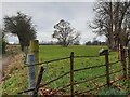
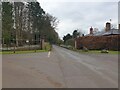
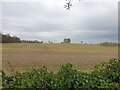
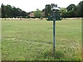
Photos of RG17 9AA


Area Information
Living in RG17 9AA defines an existence within a compact residential cluster covering 2.8 hectares. This specific postcode supports a population of 2042 people, resulting in a population density of 26 people per square kilometre. Such low density marks the location as notably spacious compared to denser urban environments. Residents here experience a quiet atmosphere where homes sit apart rather than in tight rows. The area functions as a focused settlement rather than a sprawling urban stretch. Every person here lives close to their neighbours while retaining significant open space between properties. This layout suits individuals who value privacy alongside community proximity. You will find that daily movements rely more on short drives or walks across fields than on navigating busy streets. The small scale of the postcode means that travelling from one end to the other takes moments rather than hours. This layout creates a distinctive living experience where the immediate surroundings feel like extensions of your home. Prospective buyers appreciate how the limited size keeps the environment manageable and easy to navigate. The area offers a contained setting where the boundaries of your daily life are clearly defined by the natural geography.
- Area Type
- Postcode
- Area Size
- 2.8 hectares
- Population
- 2042
- Population Density
- 26 people/km²
The property market in RG17 9AA is characterised by a strong ownership culture. Sixty-seven per cent of homes here are owned by their occupants, which fundamentally differentiates the area from high-rent metropolitan zones. Houses dominate the housing stock, meaning you will primarily encounter single-family dwellings rather than apartment blocks or purpose-built flats. This concentration of houses suggests a market driven by buyers looking for garden space and independent living arrangements. Potential purchasers should note that this postcode represents a small residential cluster where inventory may move at a different pace than in larger towns. The high ownership rate indicates a stable market where owners have deep roots in the local community. You are unlikely to find transient populations here, as most residents have stayed for the long term. This stability often translates to lower tenant turnover and more consistent neighbourhood upkeep. When searching for homes in this area, focus on standard residential properties that suit family or retirement living. The accommodation type data confirms a lack of significant flat development, so options for renters or those seeking urban density are absent. Buyers interested in traditional English homes will find this postcode aligns perfectly with their requirements. The market reflects a preference for permanence over temporary housing solutions.
House Prices in RG17 9AA
Showing 62 properties
| Address | Type | Beds | Baths | Last Sale Price | Last Sale Date | |
|---|---|---|---|---|---|---|
| 54, Inglewood House, Templeton Road, Kintbury, Hungerford, RG17 9AA | Flat | 1 | 1 | £330,000 | Sep 2025 | |
| 25, Inglewood House, Templeton Road, Kintbury, Hungerford, RG17 9AA | Flat | - | - | £650,000 | Aug 2025 | |
| 45, Inglewood House, Templeton Road, Kintbury, Hungerford, RG17 9AA | Flat | 2 | 2 | £445,000 | Aug 2025 | |
| 40, Inglewood House, Templeton Road, Kintbury, Hungerford, RG17 9AA | Flat | 2 | 2 | £390,000 | May 2025 | |
| 50, Inglewood House, Templeton Road, Kintbury, Hungerford, RG17 9AA | Flat | - | - | £340,000 | Jan 2025 | |
| 12, Inglewood House, Templeton Road, Kintbury, Hungerford, RG17 9AA | Flat | 2 | 1 | £630,000 | May 2024 | |
| 7, Inglewood House, Templeton Road, Kintbury, Hungerford, RG17 9AA | Flat | - | - | £799,995 | May 2024 | |
| 51, Inglewood House, Templeton Road, Kintbury, Hungerford, RG17 9AA | Flat | 1 | 2 | £540,000 | Mar 2024 | |
| 10, Inglewood House, Templeton Road, Kintbury, Hungerford, RG17 9AA | Flat | 2 | - | £580,000 | Dec 2023 | |
| 41, Inglewood House, Templeton Road, Kintbury, Hungerford, RG17 9AA | Flat | 2 | 2 | £499,995 | Oct 2023 |
Energy Efficiency in RG17 9AA
Residents of RG17 9AA benefit from practical access to key amenities without needing to travel far. Three railway stations lie within practical reach, including Kintbury Railway Station, Hungerford Railway Station, and Bedwyn Railway Station. This rail network provides straightforward connections to wider networks for commuting or leisure travel. Five major retail outlets serve the local population, ensuring daily shopping needs are met easily. Residents can shop at Tesco Hungerford, Asda Hungerford, and Morrisons Daily for groceries and household essentials. This selection covers the fundamental requirements for running a home without needing extensive trips to larger cities. The presence of these specific supermarkets means fresh food and household goods are always available nearby. Daily life involves convenient access to essentials while retaining the quiet of a low-density area. You can complete your weekly shop or grab a quick item without disturbing the peace of the neighbourhood. The balance between easy transport links and local retail convenience defines the practical aspects of life here. Homebuyers appreciate knowing that they do not rely solely on long drives for basic necessities.
Amenities
Schools
Families searching for schools near RG17 9AA have several options within practical reach. Inkpen Primary School operates as a primary institution with an Ofsted rating of satisfactory. Welford and Wickham C.E. Primary School also serves the local primary age group and holds a good Ofsted rating. New Barn School functions as a special school and maintains a good Ofsted rating. The mix of primary and special education facilities indicates a supportive network for diverse learning needs. Residents can choose between the two primary schools depending on their child's educational requirements and the distance to each location. The presence of a special school suggests that the broader RG17 area commits to inclusive education for children with specific needs. A satisfactory rating at Inkpen Primary and good ratings at the C.E. and special schools reflect a generally competent educational environment. Parents seeking a child-friendly environment will find multiple choices across different categories of specialisation. The proximity of these institutions to the postcode means daily commutes for children to school remain short. This arrangement supports working parents who need reliable and nearby educational options for their offspring.
| Rank | School | Type | Entry gender | Ages |
|---|
Explore more schools in this area
Go to Schools tabDemographics
The community in RG17 9AA reflects a mature demographic with a median age of 47 years. Adults aged between 30 and 64 years represent the most common age range within this population. This profile suggests a locality dominated by established families and professionals in their peak career years. Home ownership stands at 67 per cent, indicating that most residents have purchased their homes outright rather than renting. Houses comprise the primary accommodation type, meaning the street scene consists largely of detached or semi-detached residential properties. The predominant ethnic group is White, aligning with national patterns for postcodes in this specific region of England. These demographic factors shape the local culture towards stability and long-term settlement. A high ownership rate usually correlates with a stable community where neighbours tend to know each other well over extended periods. The age distribution implies that the area attracts those seeking quieter surroundings away from the energy of city centres. Families with older children or empty nesters often find this environment comfortable given the age alignment. The demographic makeup supports a robust local economy reliant on local services and establishedretail outlets. Understanding these figures helps buyers assess whether the community aligns with their expectations for lifestyle and social interaction.
Household Size
Accommodation Type
Tenure
Ethnic Group
Religion
Household Composition
Age
Household Deprivation
NS-SEC
Explore more demographic insights in this area
Go to Demographics tabPlanning
Planning Constraints
- Flood RiskPremium
- Ramsar Wetland SitesPremium
- Area of Outstanding Natural BeautyPremium
- Protected Nature ReservePremium
- Protected WoodlandPremium