Area Overview for RG17 7HD
Photos of RG17 7HD
Area Information
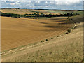
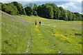
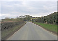
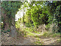
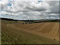
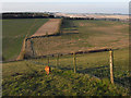
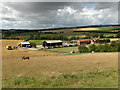
RG17 7HD comprises a specific residential cluster across 59.1 hectares in Bedfordshire. You move through a neighbourhood defined by its low density, with an average of 47 people per square kilometre. This postcode serves 1,472 residents, creating a space where homes stand apart from one another. Life here involves a slower pace driven by limited urban sprawl and a focus on quiet living. The environment prioritises space and seclusion over the intensity of city living. You find a setting that accommodates families and individuals who value room to roam. The area functions as a self-contained community rather than a hub for commercial activity or heavy transit. Your daily route likely involves travel to larger towns for services, as the local footprint remains small. This locality offers a distinct alternative to densely populated urban centres. It suits those seeking a retreat from the noise while maintaining manageable distances to key facilities. The landscape reflects a deliberate choice for lower density living. Visitors often note the spacious nature of the plots within this boundary.
- Area Type
- Postcode
- Area Size
- 59.1 hectares
- Population
- 1472
- Population Density
- 47 people/km²
The housing market in RG17 7HD operates within a framework of stability and ownership. A vast 70% of properties sit within owner-occupied households. This statistic defines the rhythm of local real estate transactions and community interaction. Houses constitute the primary accommodation type found throughout the postcode. You will find a stock built for family residence rather than dense urban dwelling. The lack of flats or high-density blocks distinguishes this area from its counterparts. Buyers looking for houses aligned with this demographic succeed here. The market reflects a preference for single-family units. This concentration creates a predictable landscape for new entrants seeking permanent homes. Fluctuations driven by rental demand are likely muted by high ownership figures. Sellers in this postcode typically deal with other owners who intend to stay. This reduces the friction often found in transitional rental markets. Your search should focus on detached, semi-detached, or terraced family homes. The absence of student blocks or purpose-built rentals aligns with the local age profile.
House Prices in RG17 7HD
Showing 6 properties
Energy Efficiency in RG17 7HD
Your daily lifestyle in RG17 7HD centres on practical convenience and local accessibility. Five retail outlets lie within practical reach, including Spar, The Southern Co-operative Co, and Morrisons Daily. These shops form the backbone of local shopping for groceries and essentials. You do not need to travel far for routine purchases or basic supplies. The variety of retailers ensures you can stock up without extensive planning. Two railway stations, Hungerford Railway Station and Kintbury Railway Station, provide direct rail access to wider connections. These stations facilitate trips to Reading, London, and other major towns. You can combine local retail with regional travel using the same transport network. Leisure activities rely on the proximity of these stations and the quiet surroundings of the postcode. The absence of major cinemas or entertainment complexes within the immediate area means you drive for nights out. However, the convenience of Spar and Morrisons keeps the heart of the home. Farming traditions and rural character likely define the social scene.
Amenities
Schools
Shefford C.E. Primary School serves as the nearest educational facility listed for the area. This institution operates at the primary level and holds a good Ofsted rating. Families in RG17 7HD rely on this school for their children's early education. The specific mention of a primary school indicates that secondary options lie further away. You must plan for transport arrangements regarding older children who would transfer to colleges outside the immediate postcode. The good rating provides a baseline of educational quality for local families. This single listing highlights a standard community provision rather than a complex educational district. Parents seeking primary school access will find a recognised option within reasonable reach. The presence of a Church of England school may influence curriculum and ethos. Commuters and those with older children will need to look beyond this specific entry for full schooling. The reliance on one named institution suggests a tight-knit local education cluster.
| Rank | School | Type | Entry gender | Ages |
|---|
Explore more schools in this area
Go to Schools tabDemographics
The community within RG17 7HD reflects an established demographic profile. The median age stands at 47 years, indicating a mature population structure. Most residents fall into the adult bracket spanning 30 to 64 years. You will observe a high level of stability, driven by a 70% home ownership rate. This figure suggests that long-term permanence characterises the household makeup. Houses dominate the accommodation landscape, with no significant presence of high-rise or flat living. Ethnic composition is predominantly White, mirroring broader regional trends in this part of England. The population lacks the volatility of short-term rentals or transient working-age singles. Families and mature couples likely form the core of your neighbours. This stability translates into a consistent community dynamic. Children grow up in an environment where the average resident has already settled. Seniors and empty nesters contribute significantly to the village character. The consistency of tenure means you deal with owners rather than landlords. This dynamic fosters a sense of neighbourhood investment and responsibility.
Household Size
Accommodation Type
Tenure
Ethnic Group
Religion
Household Composition
Age
Household Deprivation
NS-SEC
Explore more demographic insights in this area
Go to Demographics tabPlanning
Planning Constraints
- Flood RiskPremium
- Ramsar Wetland SitesPremium
- Area of Outstanding Natural BeautyPremium
- Protected Nature ReservePremium
- Protected WoodlandPremium