Area Overview for RG17 0UH
Photos of RG17 0UH
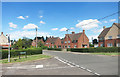
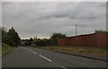
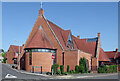
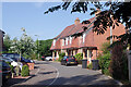
22 photos from this area
Area Information
Key information about the RG17 0UH including its size, population, and administrative classification.
- Area Type
- Postcode
- Area Size
- 5.7 hectares
- Population
- 1637
- Population Density
- 493 people/km²
House Prices in RG17 0UH
53
Properties
£605,357
Average Sold Price
£160,000
Lowest Price
£830,000
Highest Price
Showing 53 properties
| Address | Type | Beds | Baths | Last Sale Price | Last Sale Date | |
|---|---|---|---|---|---|---|
| 42 Jethro Tull Lane, Hungerford, RG17 0UH | house | - | - | £160,000 | Jan 2025 | |
| 28 Jethro Tull Lane, Hungerford, RG17 0UH | Detached | 4 | 2 | £740,000 | Nov 2024 | |
| 44 Jethro Tull Lane, Hungerford, RG17 0UH | house | - | - | £520,000 | Jul 2022 | |
| 25 Jethro Tull Lane, Hungerford, RG17 0UH | house | 4 | 2 | £610,000 | May 2022 | |
| 27 Jethro Tull Lane, Hungerford, RG17 0UH | house | - | - | £700,000 | Apr 2022 | |
| 19 Jethro Tull Lane, Hungerford, RG17 0UH | house | - | - | £690,000 | Mar 2022 | |
| 21 Jethro Tull Lane, Hungerford, RG17 0UH | house | - | - | £830,000 | Feb 2022 | |
| 30 Jethro Tull Lane, Hungerford, RG17 0UH | house | - | - | £590,000 | Dec 2021 | |
| 22 Jethro Tull Lane, Hungerford, RG17 0UH | house | - | - | £485,000 | Sep 2021 | |
| 16 Jethro Tull Lane, Hungerford, RG17 0UH | house | - | - | £650,000 | Sep 2021 |
Page 1 of 6
Energy Efficiency in RG17 0UH
Amenities
Schools
| Rank | School | Type | Entry gender | Ages |
|---|
Explore more schools in this area
Go to Schools tabDemographics
Household Size
One person
most common
Accommodation Type
Houses
most common
Tenure
55
majority
Ethnic Group
White
most common
Religion
N/A
most common
Household Composition
N/A
most common
Age
47
median
Adults (30-64 years)
most common
Household Deprivation
N/A
with no deprivation
NS-SEC
29
in Lower managerial occupations
Explore more demographic insights in this area
Go to Demographics tabPlanning
Planning Constraints
- Flood RiskPremium
- Ramsar Wetland SitesPremium
- Area of Outstanding Natural BeautyPremium
- Protected Nature ReservePremium
- Protected WoodlandPremium