Area Overview for RG17 0RE

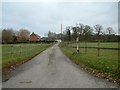
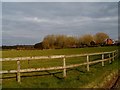
Prosperous Home Farm in RG17 0RE
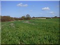
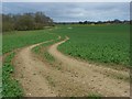
Farmland, Hungerford in RG17 0RE
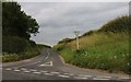
Inkpen Road at the junction of the A338 in RG17 0RE
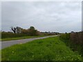
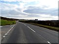
A338 near Prosperous Home Farm in RG17 0RE
A338 junction with Minor road to Sanham Green in RG17 0RE
Prosperous Home Farm, evening light in RG17 0RE
Farmland near Hungerford in RG17 0RE
A338 Salisbury Road in RG17 0RE
Old Milestone by the A338, south of Hungerford in RG17 0RE
9 photos from this area

Area Information

Key information about the RG17 0RE including its size, population, and administrative classification.

Area Type
Postcode
Area Size
94.8 hectares
Population
1186
Population Density
52 people/km²

House Prices in RG17 0RE

10
Properties
£1,462,500
Average Sold Price
£1,300,000
Lowest Price
£1,625,000
Highest Price

Showing 10 properties

AddressTypeBedsBathsLast Sale PriceLast Sale Date
Westcott House, Annetts Lane North East And Then South East By Slope End Farm To County Boundary Near Shalbourne, Stype, RG17 0REDetached64£1,300,000Dec 2017
The Old Mill House, Annetts Lane North East And Then South East By Slope End Farm To County Boundary Near Shalbourne, Stype, RG17 0REhouse--£1,625,000Oct 2014
Lower Slope House, Annetts Lane North East And Then South East By Slope End Farm To County Boundary Near Shalbourne, Stype, RG17 0REDetached63--
Upper Westcott, Annetts Lane North East And Then South East By Slope End Farm To County Boundary Near Shalbourne, Stype, RG17 0REDetached56--
Annexe, Westcott House, Annetts Lane North East And Then South East By Slope End Farm To County Boundary Near Shalbourne, Stype, RG17 0REFlat----
Bagshot Farmhouse, Annetts Lane North East And Then South East By Slope End Farm To County Boundary Near Shalbourne, Stype, RG17 0REDetached----
Bagshot Gate House, Annetts Lane North East And Then South East By Slope End Farm To County Boundary Near Shalbourne, Stype, RG17 0REhouse----
Lower Slope End Farm, Annetts Lane North East And Then South East By Slope End Farm To County Boundary Near Shalbourne, Stype, RG17 0REDetached----
The Pink Door Ltd, Units 4 And 5, The Courtyard, Annetts Lane North East And Then South East By Slope End Farm To County Boundary Near Shalbourne, Stype, RG17 0REretail_financial----
Annexe, The Old Mill House, Annetts Lane North East And Then South East By Slope End Farm To County Boundary Near Shalbourne, Stype, RG17 0REFlat----

Energy Efficiency in RG17 0RE

Amenities

Schools

RankSchoolTypeEntry genderAges

Explore more schools in this area

Go to Schools tab

Demographics

Household Size

One person
most common

Accommodation Type

Houses
most common

Tenure

61
majority

Ethnic Group

White
most common

Religion

N/A
most common

Household Composition

N/A
most common

Age

47
median
Adults (30-64 years)
most common

Household Deprivation

N/A
with no deprivation

NS-SEC

41
in Lower managerial occupations

Explore more demographic insights in this area

Go to Demographics tab

Planning

Planning Constraints

  • Flood Risk
    Premium
  • Ramsar Wetland Sites
    Premium
  • Area of Outstanding Natural Beauty
    Premium
  • Protected Nature Reserve
    Premium
  • Protected Woodland
    Premium

Explore more planning insights in this area

Open Planning map

Nearby Areas

We use cookies to provide you with the best experience. By continuing, you agree to our Cookie Policy .