Area Overview for RG17 0JF
Photos of RG17 0JF
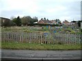
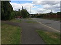
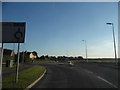
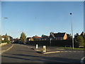
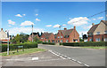
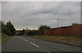
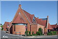
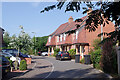
22 photos from this area
Area Information
Key information about the RG17 0JF including its size, population, and administrative classification.
- Area Type
- Postcode
- Area Size
- 7.9 hectares
- Population
- 1489
- Population Density
- 1592 people/km²
House Prices in RG17 0JF
41
Properties
£264,503
Average Sold Price
£78,500
Lowest Price
£485,000
Highest Price
Showing 41 properties
| Address | Type | Beds | Baths | Last Sale Price | Last Sale Date | |
|---|---|---|---|---|---|---|
| 54 Chilton Way, Hungerford, RG17 0JF | Terraced | 3 | 1 | £280,000 | Nov 2025 | |
| 75 Chilton Way, Hungerford, RG17 0JF | house | 4 | 1 | £485,000 | Sep 2024 | |
| 56 Chilton Way, Hungerford, RG17 0JF | Terraced | 4 | 1 | £375,000 | Aug 2024 | |
| 62 Chilton Way, Hungerford, RG17 0JF | Semi-detached | 3 | 1 | £322,000 | May 2024 | |
| 87 Chilton Way, Hungerford, RG17 0JF | house | - | - | £290,000 | Jan 2024 | |
| 103 Chilton Way, Hungerford, RG17 0JF | Detached | 4 | 1 | £443,000 | Nov 2023 | |
| 64 Chilton Way, Hungerford, RG17 0JF | Semi-detached | 3 | 1 | £345,000 | Sep 2023 | |
| 71 Chilton Way, Hungerford, RG17 0JF | Detached | 4 | 1 | £476,000 | Sep 2022 | |
| 66 Chilton Way, Hungerford, RG17 0JF | house | - | - | £358,000 | Sep 2021 | |
| 72 Chilton Way, Hungerford, RG17 0JF | house | - | - | £420,000 | Sep 2021 |
Page 1 of 5
Energy Efficiency in RG17 0JF
Amenities
Schools
| Rank | School | Type | Entry gender | Ages |
|---|
Explore more schools in this area
Go to Schools tabDemographics
Household Size
Two person
most common
Accommodation Type
Houses
most common
Tenure
67
majority
Ethnic Group
White
most common
Religion
N/A
most common
Household Composition
N/A
most common
Age
47
median
Adults (30-64 years)
most common
Household Deprivation
N/A
with no deprivation
NS-SEC
38
in Lower managerial occupations
Explore more demographic insights in this area
Go to Demographics tabPlanning
Planning Constraints
- Flood RiskPremium
- Ramsar Wetland SitesPremium
- Area of Outstanding Natural BeautyPremium
- Protected Nature ReservePremium
- Protected WoodlandPremium