Area Overview for RG17 0HH
Photos of RG17 0HH
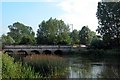
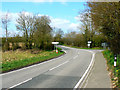
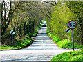
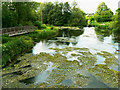
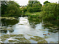
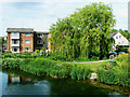

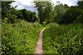
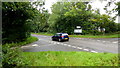
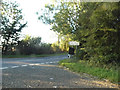
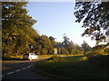
47 photos from this area
Area Information
Key information about the RG17 0HH including its size, population, and administrative classification.
- Area Type
- Postcode
- Area Size
- 27.2 hectares
- Population
- 1186
- Population Density
- 52 people/km²
House Prices in RG17 0HH
16
Properties
£294,980
Average Sold Price
£137,000
Lowest Price
£610,000
Highest Price
Showing 16 properties
| Address | Type | Beds | Baths | Last Sale Price | Last Sale Date | |
|---|---|---|---|---|---|---|
| 18 Upper Eddington, Eddington, Hungerford, RG17 0HH | Terraced | 1 | 1 | £190,000 | Mar 2022 | |
| 19 Upper Eddington, Eddington, Hungerford, RG17 0HH | house | - | - | £411,000 | Dec 2021 | |
| 17 Upper Eddington, Eddington, Hungerford, RG17 0HH | Terraced | 1 | - | £200,000 | Nov 2021 | |
| 16 Upper Eddington, Eddington, Hungerford, RG17 0HH | Terraced | 1 | 1 | £200,000 | Nov 2021 | |
| 15 Upper Eddington, Eddington, Hungerford, RG17 0HH | Terraced | 2 | 1 | £217,000 | Oct 2021 | |
| 8 Upper Eddington, Eddington, Hungerford, RG17 0HH | Terraced | 2 | - | £249,000 | Jul 2019 | |
| Riverbend, Upper Eddington, Eddington, Hungerford, RG17 0HH | Detached | 2 | 1 | £610,000 | Dec 2017 | |
| 14 Upper Eddington, Eddington, Hungerford, RG17 0HH | house | 2 | 1 | £195,000 | Oct 2015 | |
| 13 Upper Eddington, Eddington, Hungerford, RG17 0HH | Detached | 4 | 2 | £595,000 | Sep 2014 | |
| 10 Upper Eddington, Eddington, Hungerford, RG17 0HH | Terraced | 2 | 1 | £230,745 | Apr 2007 |
Page 1 of 2
Energy Efficiency in RG17 0HH
Amenities
Schools
| Rank | School | Type | Entry gender | Ages |
|---|
Explore more schools in this area
Go to Schools tabDemographics
Household Size
One person
most common
Accommodation Type
Houses
most common
Tenure
61
majority
Ethnic Group
White
most common
Religion
N/A
most common
Household Composition
N/A
most common
Age
47
median
Adults (30-64 years)
most common
Household Deprivation
N/A
with no deprivation
NS-SEC
41
in Lower managerial occupations
Explore more demographic insights in this area
Go to Demographics tabPlanning
Planning Constraints
- Flood RiskPremium
- Ramsar Wetland SitesPremium
- Area of Outstanding Natural BeautyPremium
- Protected Nature ReservePremium
- Protected WoodlandPremium