Area Overview for RG17 0EY
Photos of RG17 0EY

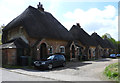
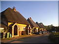

21 photos from this area
Area Information
Key information about the RG17 0EY including its size, population, and administrative classification.
- Area Type
- Postcode
- Area Size
- 2.5 hectares
- Population
- 1186
- Population Density
- 52 people/km²
House Prices in RG17 0EY
20
Properties
-
Average Sold Price
-
Lowest Price
-
Highest Price
Showing 20 properties
| Address | Type | Beds | Baths | Last Sale Price | Last Sale Date | |
|---|---|---|---|---|---|---|
| The Longford Group Ltd, Ground Floor, Merlin House, Charnham Lane, Hungerford, RG17 0EY | Office | - | - | - | - | |
| Mxd Ltd, Ground Floor South, Quill House, Charnham Lane, Hungerford, RG17 0EY | Office | - | - | - | - | |
| N F U Mutual Insurance Society Ltd, Ground Floor, Dunn House, Charnham Lane, Hungerford, RG17 0EY | office_workshop | - | - | - | - | |
| First Floor, Quill House, Charnham Lane, Hungerford, RG17 0EY | office_workshop | - | - | - | - | |
| Office 6, Chilton House, Charnham Lane, Hungerford, RG17 0EY | Office | - | - | - | - | |
| Kennet Tyre Services Ltd, 2 Charnham Lane, Hungerford, RG17 0EY | office_workshop | - | - | - | - | |
| Office 2, Chilton House, Charnham Lane, Hungerford, RG17 0EY | Office | - | - | - | - | |
| Db Concepts, Office 3, Chilton House, Charnham Lane, Hungerford, RG17 0EY | Office | - | - | - | - | |
| Reprotec Ltd, Ground Floor East, Quill House, Charnham Lane, Hungerford, RG17 0EY | Office | - | - | - | - | |
| Cgs, 5 Charnham Lane, Hungerford, RG17 0EY | general_industrial | - | - | - | - |
Page 1 of 2
Energy Efficiency in RG17 0EY
Amenities
Schools
| Rank | School | Type | Entry gender | Ages |
|---|
Explore more schools in this area
Go to Schools tabDemographics
Household Size
One person
most common
Accommodation Type
Houses
most common
Tenure
61
majority
Ethnic Group
White
most common
Religion
N/A
most common
Household Composition
N/A
most common
Age
47
median
Adults (30-64 years)
most common
Household Deprivation
N/A
with no deprivation
NS-SEC
41
in Lower managerial occupations
Explore more demographic insights in this area
Go to Demographics tabPlanning
Planning Constraints
- Flood RiskPremium
- Ramsar Wetland SitesPremium
- Area of Outstanding Natural BeautyPremium
- Protected Nature ReservePremium
- Protected WoodlandPremium