Area Overview for RG17 0EA
Photos of RG17 0EA
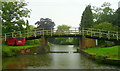
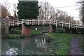
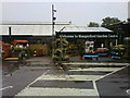
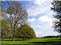
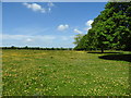
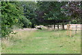
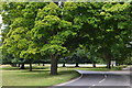
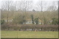
100 photos from this area
Area Information
Key information about the RG17 0EA including its size, population, and administrative classification.
- Area Type
- Postcode
- Area Size
- 5749 m²
- Population
- 1554
- Population Density
- 3918 people/km²
House Prices in RG17 0EA
15
Properties
£362,636
Average Sold Price
£50,000
Lowest Price
£935,000
Highest Price
Showing 15 properties
| Address | Type | Beds | Baths | Last Sale Price | Last Sale Date | |
|---|---|---|---|---|---|---|
| 30 Park Street, Hungerford, RG17 0EA | Detached | 4 | 3 | £935,000 | Oct 2024 | |
| Godwin House, 31A Park Street, Hungerford, RG17 0EA | Semi-detached | 2 | 2 | £433,180 | Mar 2021 | |
| 26 Park Street, Hungerford, RG17 0EA | Semi-detached | 2 | - | £250,000 | Jun 2015 | |
| 27 Park Street, Hungerford, RG17 0EA | Semi-detached | - | - | £50,000 | Jun 1998 | |
| 32 Park Street, Hungerford, RG17 0EA | Detached | - | - | £145,000 | Sep 1995 | |
| 5, Crofton House, Park Street, Hungerford, RG17 0EA | Flat | 1 | 1 | - | - | |
| 4, Crofton House, Park Street, Hungerford, RG17 0EA | Flat | 1 | 1 | - | - | |
| Apartment 1, The Old Police House, 31 Park Street, Hungerford, RG17 0EA | Flat | 2 | 2 | - | - | |
| Apartment 4, The Old Police House, 31 Park Street, Hungerford, RG17 0EA | Flat | 3 | 3 | - | - | |
| 1, Crofton House, Park Street, Hungerford, RG17 0EA | Flat | 1 | 1 | - | - |
Page 1 of 2
Energy Efficiency in RG17 0EA
Amenities
Schools
| Rank | School | Type | Entry gender | Ages |
|---|
Explore more schools in this area
Go to Schools tabDemographics
Household Size
One person
most common
Accommodation Type
Houses
most common
Tenure
62
majority
Ethnic Group
White
most common
Religion
N/A
most common
Household Composition
N/A
most common
Age
47
median
Adults (30-64 years)
most common
Household Deprivation
N/A
with no deprivation
NS-SEC
39
in Lower managerial occupations
Explore more demographic insights in this area
Go to Demographics tabPlanning
Planning Constraints
- Flood RiskPremium
- Ramsar Wetland SitesPremium
- Area of Outstanding Natural BeautyPremium
- Protected Nature ReservePremium
- Protected WoodlandPremium