Area Overview for RG17 0AJ
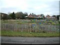
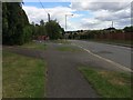
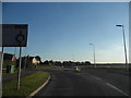
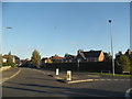
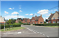
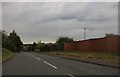
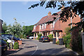
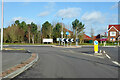
Photos of RG17 0AJ


Area Information
Living in RG17 0AJ offers a quiet residential experience within a small cluster of properties. This specific postcode covers just 7,531 square metres, creating an intimate community footprint. The area houses 1,637 people, which translates to a density of 493 inhabitants per square kilometre. This concentration suggests a neighbourhood where residents know one another, yet distances between homes remain short. Daily life here is defined by proximity to nearby towns while enjoying a peaceful, low-density rural setting. You will find the layout prioritises private living spaces over high-density urban blocks. The environment supports a slower pace of life, typical of villages and small settlements in the surrounding region. Homebuyers often choose this location for the balance between rural tranquility and sufficient access to local services. The limited size of the cluster means that the character of the area remains consistent throughout, without the sudden shifts in amenity types found in larger districts.
- Area Type
- Postcode
- Area Size
- 7531 m²
- Population
- 1637
- Population Density
- 493 people/km²
The housing market in RG17 0AJ is characterised by a strong preference for traditional detached or semi-detached dwellings. Houses form the main accommodation type, reflecting the established nature of the built environment. Half of the residents, equating to roughly 840 people, own their homes, underscoring that this is primarily an owner-occupied location. This high level of ownership often means properties are well-maintained and purchased for long-term living rather than short-term investment. Buyers looking at homes in this postcode should expect a stock dominated by residential houses suitable for permanent settlement. The small area size of 7,531 square metres limits the volume of available properties, making specific listings highly sought after. Those considering rental options will find fewer vacancies compared to larger urban centres. The market here is likely reflective of local supply rather than broad regional housing trends. Prospective buyers value the stability that comes with a predominantly owner-stocked neighbourhood.
House Prices in RG17 0AJ
Showing 24 properties
| Address | Type | Beds | Baths | Last Sale Price | Last Sale Date | |
|---|---|---|---|---|---|---|
| 62 Priory Road, Hungerford, RG17 0AJ | Terraced | 3 | 1 | £335,000 | Nov 2023 | |
| 4, Hedge End, Priory Road, Hungerford, RG17 0AJ | house | 4 | 3 | £415,000 | Nov 2022 | |
| 40 Priory Road, Hungerford, RG17 0AJ | Terraced | 3 | 1 | £265,000 | Dec 2018 | |
| 70 Priory Road, Hungerford, RG17 0AJ | Semi-detached | 3 | - | £235,000 | Mar 2014 | |
| 68 Priory Road, Hungerford, RG17 0AJ | house | 3 | 1 | £234,000 | Oct 2013 | |
| 76 Priory Road, Hungerford, RG17 0AJ | house | 3 | - | £250,000 | Jul 2013 | |
| 74 Priory Road, Hungerford, RG17 0AJ | house | 3 | - | £236,000 | Aug 2012 | |
| 2, Hedge End, Priory Road, Hungerford, RG17 0AJ | house | 4 | - | £268,000 | Apr 2012 | |
| 54 Priory Road, Hungerford, RG17 0AJ | Terraced | 3 | 1 | £152,500 | Mar 2007 | |
| 66 Priory Road, Hungerford, RG17 0AJ | Terraced | - | - | £212,500 | Sep 2006 |
Energy Efficiency in RG17 0AJ
Your daily lifestyle in RG17 0AJ is supported by a cluster of practical amenities within reach. Three railway stations provide rail access: Hungerford Railway Station, Kintbury Railway Station, and Bedwyn Railway Station. These stops offer connections to wider networks for travel and commuting. For shopping needs, five notable retailers are available within practical distance. You can visit Morrisons Daily for convenience goods, Tesco Hungerford for larger groceries, and Asda Hungerford for further retail needs. These three major supermarkets ensure that household shopping trips require minimal travel time. The presence of multiple transport hubs and retail chains means you do not need to travel far for essential services. Living in this area provides a self-contained experience where daily chores are handled locally. You can easily balance home life with occasional trips to larger towns for specialised services or leisure activities.
Amenities
Schools
Families living in RG17 0AJ have access to education faculties through the John O'Gaunt School. This institution serves as a primary school for young children. It also operates as an academy with a Ofsted rating of good, providing a reliable standard of education for older students. The presence of the academy designation confirms that the school meets national standards for curriculum implementation and student outcomes. While only one educational facility is listed directly near your location, the dual function of John O'Gaunt School indicates a combined provision for different age groups. This arrangement simplifies planning for parents staying within the vicinity of the property. The good rating is a significant positive factor for those choosing living in this area based on educational quality. You do not need to look far for schooling options, as the necessary infrastructure exists within the immediate neighbourhood.
| Rank | School | Type | Entry gender | Ages |
|---|
Explore more schools in this area
Go to Schools tabDemographics
The community in RG17 0AJ reflects a stable, mature population structure. Half of the residents are aged between 30 and 64 years, making adults the dominant age group in the neighbourhood. The median age stands at 47, indicating a largely established household rather than a young, transient population. This age profile aligns with the accommodation type, which consists primarily of houses rather than apartments or high-density rentals. Home ownership is prevalent, with 55% of residents owning their property outright or with a mortgage. The remaining 45% likely rents or shares ownership. The predominant ethnic group in this sector is White, which is consistent with the broader demographic trends of many rural English villages. While no detailed deprivation data is provided, the high home ownership rate and stable age range suggest a financially secure environment. Most families have been living here for several years, contributing to a sense of continuity within the community.
Household Size
Accommodation Type
Tenure
Ethnic Group
Religion
Household Composition
Age
Household Deprivation
NS-SEC
Explore more demographic insights in this area
Go to Demographics tabPlanning
Planning Constraints
- Flood RiskPremium
- Ramsar Wetland SitesPremium
- Area of Outstanding Natural BeautyPremium
- Protected Nature ReservePremium
- Protected WoodlandPremium