Area Overview for RG14 6PU
Photos of RG14 6PU
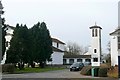
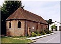
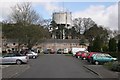
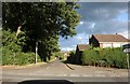
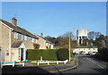
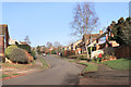
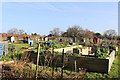
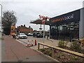
100 photos from this area
Area Information
Key information about the RG14 6PU including its size, population, and administrative classification.
- Area Type
- Postcode
- Area Size
- 2.7 hectares
- Population
- 1424
- Population Density
- 1181 people/km²
House Prices in RG14 6PU
40
Properties
£376,684
Average Sold Price
£74,950
Lowest Price
£780,000
Highest Price
Showing 40 properties
| Address | Type | Beds | Baths | Last Sale Price | Last Sale Date | |
|---|---|---|---|---|---|---|
| 43 Gorselands, Newbury, RG14 6PU | Flat | 2 | 1 | £245,000 | Dec 2025 | |
| 21 Gorselands, Newbury, RG14 6PU | Maisonette | 2 | 1 | £239,950 | Mar 2025 | |
| 35 Gorselands, Newbury, RG14 6PU | Flat | 3 | 2 | £246,300 | Feb 2024 | |
| 37 Gorselands, Newbury, RG14 6PU | Flat | - | - | £250,000 | Oct 2023 | |
| 71 Gorselands, Newbury, RG14 6PU | Detached | 4 | 2 | £650,000 | Dec 2022 | |
| 25 Gorselands, Newbury, RG14 6PU | Flat | 2 | 1 | £250,000 | May 2022 | |
| 11 Gorselands, Newbury, RG14 6PU | house | - | - | £780,000 | Jul 2021 | |
| 39 Gorselands, Newbury, RG14 6PU | Flat | - | - | £240,500 | Feb 2020 | |
| 83 Gorselands, Newbury, RG14 6PU | Bungalow | 4 | 2 | £451,000 | Feb 2020 | |
| 55 Gorselands, Newbury, RG14 6PU | Detached | 4 | 2 | £470,000 | Apr 2019 |
Page 1 of 4
Energy Efficiency in RG14 6PU
Amenities
Schools
| Rank | School | Type | Entry gender | Ages |
|---|
Explore more schools in this area
Go to Schools tabDemographics
Household Size
Two person
most common
Accommodation Type
Houses
most common
Tenure
88
majority
Ethnic Group
White
most common
Religion
N/A
most common
Household Composition
N/A
most common
Age
47
median
Adults (30-64 years)
most common
Household Deprivation
N/A
with no deprivation
NS-SEC
56
in Lower managerial occupations
Explore more demographic insights in this area
Go to Demographics tabPlanning
Planning Constraints
- Flood RiskPremium
- Ramsar Wetland SitesPremium
- Area of Outstanding Natural BeautyPremium
- Protected Nature ReservePremium
- Protected WoodlandPremium