Area Overview for RG14 6LA
Photos of RG14 6LA
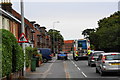
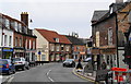
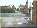
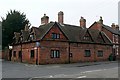
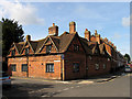
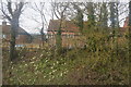
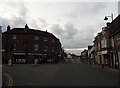
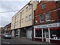

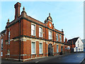
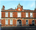
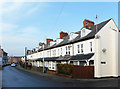
100 photos from this area
Area Information
Key information about the RG14 6LA including its size, population, and administrative classification.
- Area Type
- Postcode
- Area Size
- 2.4 hectares
- Population
- 1903
- Population Density
- 3380 people/km²
House Prices in RG14 6LA
35
Properties
£358,220
Average Sold Price
£125,000
Lowest Price
£705,000
Highest Price
Showing 35 properties
| Address | Type | Beds | Baths | Last Sale Price | Last Sale Date | |
|---|---|---|---|---|---|---|
| 24 Bartlemy Road, Newbury, RG14 6LA | Detached | 4 | 2 | £697,500 | Oct 2025 | |
| 30 Bartlemy Road, Newbury, RG14 6LA | Semi-detached | 3 | 1 | £650,000 | Aug 2025 | |
| 76 Bartlemy Road, Newbury, RG14 6LA | Detached | 4 | 2 | £705,000 | Jul 2024 | |
| 64 Bartlemy Road, Newbury, RG14 6LA | Semi-detached | 3 | 1 | £450,000 | Dec 2023 | |
| 36 Bartlemy Road, Newbury, RG14 6LA | house | - | - | £690,000 | Nov 2022 | |
| 38 Bartlemy Road, Newbury, RG14 6LA | Semi-detached | 3 | 1 | £475,000 | Dec 2020 | |
| 28 Bartlemy Road, Newbury, RG14 6LA | Semi-detached | 3 | 1 | £458,500 | Sep 2020 | |
| 50 Bartlemy Road, Newbury, RG14 6LA | Semi-detached | 3 | 1 | £423,000 | Jul 2019 | |
| 34 Bartlemy Road, Newbury, RG14 6LA | Semi-detached | 3 | 2 | £375,000 | Nov 2017 | |
| 66 Bartlemy Road, Newbury, RG14 6LA | house | 3 | 1 | £485,000 | Jun 2017 |
Page 1 of 4
Energy Efficiency in RG14 6LA
Amenities
Schools
| Rank | School | Type | Entry gender | Ages |
|---|
Explore more schools in this area
Go to Schools tabDemographics
Household Size
Family (3-5 people)
most common
Accommodation Type
Houses
most common
Tenure
79
majority
Ethnic Group
White
most common
Religion
N/A
most common
Household Composition
N/A
most common
Age
47
median
Adults (30-64 years)
most common
Household Deprivation
N/A
with no deprivation
NS-SEC
49
in Lower managerial occupations
Explore more demographic insights in this area
Go to Demographics tabPlanning
Planning Constraints
- Flood RiskPremium
- Ramsar Wetland SitesPremium
- Area of Outstanding Natural BeautyPremium
- Protected Nature ReservePremium
- Protected WoodlandPremium