Area Overview for RG14 6HB
Photos of RG14 6HB
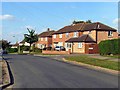
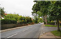
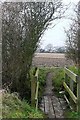
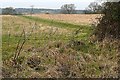
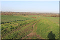
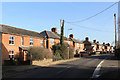
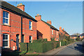
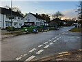
100 photos from this area
Area Information
Key information about the RG14 6HB including its size, population, and administrative classification.
- Area Type
- Postcode
- Area Size
- 10.0 hectares
- Population
- 1589
- Population Density
- 90 people/km²
House Prices in RG14 6HB
50
Properties
£255,967
Average Sold Price
£56,000
Lowest Price
£400,000
Highest Price
Showing 50 properties
| Address | Type | Beds | Baths | Last Sale Price | Last Sale Date | |
|---|---|---|---|---|---|---|
| 39 Middle Close, Newbury, RG14 6HB | Terraced | 2 | 1 | £326,000 | Aug 2023 | |
| 31 Middle Close, Newbury, RG14 6HB | house | - | - | £355,000 | Jul 2022 | |
| 57 Middle Close, Newbury, RG14 6HB | Terraced | 4 | 3 | £400,000 | Feb 2022 | |
| 4 Middle Close, Newbury, RG14 6HB | Semi-detached | 3 | 1 | £329,000 | Jun 2021 | |
| 79 Middle Close, Newbury, RG14 6HB | Semi-detached | 3 | 1 | £345,000 | Jan 2021 | |
| 19 Middle Close, Newbury, RG14 6HB | Semi-detached | 3 | 1 | £310,000 | Jun 2020 | |
| 16A Middle Close, Newbury, RG14 6HB | house | 3 | - | £344,000 | Aug 2018 | |
| 73 Middle Close, Newbury, RG14 6HB | Semi-detached | 3 | 1 | £295,000 | Nov 2016 | |
| 3 Middle Close, Newbury, RG14 6HB | house | - | - | £243,000 | Aug 2015 | |
| 55 Middle Close, Newbury, RG14 6HB | Semi-detached | 3 | 1 | £280,000 | Aug 2015 |
Page 1 of 5
Energy Efficiency in RG14 6HB
Amenities
Schools
| Rank | School | Type | Entry gender | Ages |
|---|
Explore more schools in this area
Go to Schools tabDemographics
Household Size
Two person
most common
Accommodation Type
Houses
most common
Tenure
70
majority
Ethnic Group
White
most common
Religion
N/A
most common
Household Composition
N/A
most common
Age
47
median
Adults (30-64 years)
most common
Household Deprivation
N/A
with no deprivation
NS-SEC
43
in Lower managerial occupations
Explore more demographic insights in this area
Go to Demographics tabPlanning
Planning Constraints
- Flood RiskPremium
- Ramsar Wetland SitesPremium
- Area of Outstanding Natural BeautyPremium
- Protected Nature ReservePremium
- Protected WoodlandPremium