Area Overview for RG14 5UL
Photos of RG14 5UL
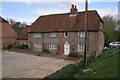
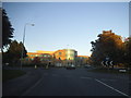
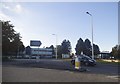
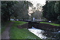

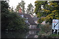
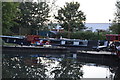
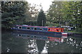
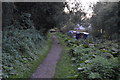
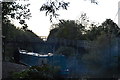

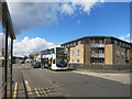
100 photos from this area
Area Information
Key information about the RG14 5UL including its size, population, and administrative classification.
- Area Type
- Postcode
- Area Size
- 3574 m²
- Population
- 1851
- Population Density
- 3448 people/km²
House Prices in RG14 5UL
9
Properties
£128,383
Average Sold Price
£59,950
Lowest Price
£197,500
Highest Price
Showing 9 properties
| Address | Type | Beds | Baths | Last Sale Price | Last Sale Date | |
|---|---|---|---|---|---|---|
| 4, Heron House, Two Rivers Way, Newbury, RG14 5UL | Flat | - | - | £185,000 | Jul 2023 | |
| 7, Heron House, Two Rivers Way, Newbury, RG14 5UL | Flat | - | - | £197,000 | Feb 2022 | |
| 1, Heron House, Two Rivers Way, Newbury, RG14 5UL | Flat | - | - | £197,500 | Oct 2021 | |
| 9, Heron House, Two Rivers Way, Newbury, RG14 5UL | Flat | - | - | £132,000 | Dec 2012 | |
| 2, Heron House, Two Rivers Way, Newbury, RG14 5UL | Flat | 2 | 2 | £150,500 | May 2011 | |
| 3, Heron House, Two Rivers Way, Newbury, RG14 5UL | Flat | - | - | £87,500 | Mar 1999 | |
| 8, Heron House, Two Rivers Way, Newbury, RG14 5UL | Flat | - | - | £59,950 | Apr 1998 | |
| 6, Heron House, Two Rivers Way, Newbury, RG14 5UL | Flat | - | - | £73,000 | Apr 1998 | |
| 5, Heron House, Two Rivers Way, Newbury, RG14 5UL | Flat | - | - | £73,000 | Apr 1997 |
Energy Efficiency in RG14 5UL
Amenities
Schools
| Rank | School | Type | Entry gender | Ages |
|---|
Explore more schools in this area
Go to Schools tabDemographics
Household Size
Family (3-5 people)
most common
Accommodation Type
Houses
most common
Tenure
52
majority
Ethnic Group
White
most common
Religion
N/A
most common
Household Composition
N/A
most common
Age
47
median
Adults (30-64 years)
most common
Household Deprivation
N/A
with no deprivation
NS-SEC
30
in Lower managerial occupations
Explore more demographic insights in this area
Go to Demographics tabPlanning
Planning Constraints
- Flood RiskPremium
- Ramsar Wetland SitesPremium
- Area of Outstanding Natural BeautyPremium
- Protected Nature ReservePremium
- Protected WoodlandPremium