Area Overview for RG14 1TF
Photos of RG14 1TF

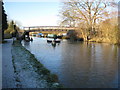
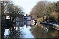
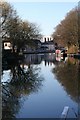
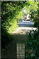


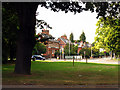
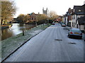
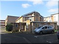
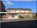
100 photos from this area
Area Information
Key information about the RG14 1TF including its size, population, and administrative classification.
- Area Type
- Postcode
- Area Size
- 4582 m²
- Population
- 1971
- Population Density
- 3631 people/km²
House Prices in RG14 1TF
26
Properties
£256,245
Average Sold Price
£197,995
Lowest Price
£345,000
Highest Price
Showing 26 properties
| Address | Type | Beds | Baths | Last Sale Price | Last Sale Date | |
|---|---|---|---|---|---|---|
| 12, Telford Court, Old College Road, Newbury, RG14 1TF | Flat | - | - | £315,000 | Dec 2024 | |
| 1, Telford Court, Old College Road, Newbury, RG14 1TF | Flat | - | - | £262,500 | Jun 2024 | |
| 7, Telford Court, Old College Road, Newbury, RG14 1TF | Flat | 2 | 2 | £235,000 | Aug 2023 | |
| 8, Telford Court, Old College Road, Newbury, RG14 1TF | Flat | 2 | 2 | £250,000 | Sep 2021 | |
| 21, Telford Court, Old College Road, Newbury, RG14 1TF | Flat | 2 | 2 | £320,000 | Jun 2021 | |
| 5, Telford Court, Old College Road, Newbury, RG14 1TF | Flat | - | - | £320,000 | Jan 2021 | |
| 18, Telford Court, Old College Road, Newbury, RG14 1TF | Flat | - | - | £320,000 | Dec 2020 | |
| 25, Telford Court, Old College Road, Newbury, RG14 1TF | Flat | 2 | 2 | £345,000 | Apr 2019 | |
| 2, Telford Court, Old College Road, Newbury, RG14 1TF | Flat | - | - | £325,000 | Sep 2016 | |
| 27, Telford Court, Old College Road, Newbury, RG14 1TF | Flat | - | - | £270,000 | Oct 2015 |
Page 1 of 3
Energy Efficiency in RG14 1TF
Amenities
Schools
| Rank | School | Type | Entry gender | Ages |
|---|
Explore more schools in this area
Go to Schools tabDemographics
Household Size
One person
most common
Accommodation Type
Houses
most common
Tenure
51
majority
Ethnic Group
White
most common
Religion
N/A
most common
Household Composition
N/A
most common
Age
47
median
Adults (30-64 years)
most common
Household Deprivation
N/A
with no deprivation
NS-SEC
36
in Lower managerial occupations
Explore more demographic insights in this area
Go to Demographics tabPlanning
Planning Constraints
- Flood RiskPremium
- Ramsar Wetland SitesPremium
- Area of Outstanding Natural BeautyPremium
- Protected Nature ReservePremium
- Protected WoodlandPremium