Area Overview for RG12 9QQ
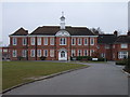
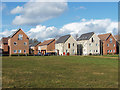
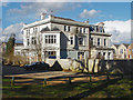
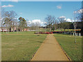
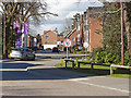
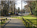
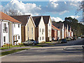
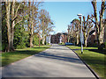
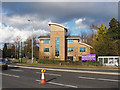
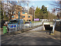
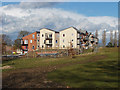
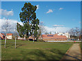
Photos of RG12 9QQ
Area Information
Living in RG12 9QQ offers a distinct residential experience centred around a small, tightly defined cluster. This postcode covers just 982 square metres, creating an intimate neighbourhood where residents know their surroundings by heart. The area is home to 1,886 people, fostering a close-knit environment rather than the sprawling developments found elsewhere in Berkshire. You will find yourself stepping into a community where daily interactions likely involve familiar faces on the street and a deep sense of local belonging. The density here is high, yet the character remains residential and manageable. This specificity makes RG12 9QQ unique compared to broader postal districts, as it represents a precise slice of housing sought by those who value proximity and community. For anyone considering homes in RG12 9QQ, the appeal lies in this concentrated nature; it is not merely a location but a specific pocket of life within the wider Bracknell landscape. The small footprint means you can walk to key services found nearby, avoiding the need for long commutes to reach essentials.
- Area Type
- Postcode
- Area Size
- 982 m²
- Population
- 1886
- Population Density
- 3346 people/km²
The property market in RG12 9QQ is characterised by a balanced split between owners and renters. With 52% home ownership, the area sits near the national average, preventing the extreme youthfulness often seen in high-rent boroughs. This figure indicates a healthy mix of long-term residents and tenants, creating a stable housing stock. The dominant accommodation type here is flats, which distinguishes RG12 9QQ from areas dominated by detached houses or terraced rows. This prevalence of flats suits the small 982 square metre footprint of the postcode, maximising the use of limited land while providing multiple homes for the 1,886 people residing here. You are likely to find a variety of flat configurations rather than standard semi-detached properties. This market structure appeals to buyers seeking low-maintenance living within a specific, manageable zone. Whether you are looking to buy a flat in RG12 9QQ or rent one, the options reflect a mature market catering predominantly to adults over 30. The concentration of flats ensures that noise levels and shared walls are standard considerations for every prospective buyer in this cluster.
House Prices in RG12 9QQ
No properties found in this postcode.
Energy Efficiency in RG12 9QQ
Your daily life in RG12 9QQ is defined by convenience, with key amenities situated within practical reach. For your essential grocery shopping, you have three major options nearby: Budgens Harmans, Morrisons Daily, and Tesco Bracknell. Access to these three supermarkets means you can compare prices, stock, and locations without driving far from your flat. Beyond retail, transport links are equally accessible, with five railway stations serving the area including Bracknell Railway Station, Martins Heron Railway Station, and Ascot Railway Station. This network of rail links provides quick connectivity to London and the wider South East, essential for commuters. The presence of multiple retail choices and rail hubs means you rarely need to leave the immediate vicinity for daily necessities. Living here places you moments away from the conveniences of Bracknell town centre. You can finish your morning coffee at a local cafe before heading out, or pop to the nearest supermarket on your way home from the station. This blend of retail variety and transport efficiency defines the easy, hassle-free lifestyle available in this postcode.
Amenities
Schools
Families living in RG12 9QQ benefit from immediate access to quality education within walking distance. Holly Spring Junior School serves the local primary education needs, providing a dedicated space for younger children's development. Directly nearby, Holly Spring Primary School holds a 'good' Ofsted rating, a testament to its educational standard and the quality of learning provided to its students. The presence of both a junior and a primary school ensures that younger families have convenient access to multiple educational stages without long commutes. This proximity is a significant advantage for parents working in neighbouring towns, as drop-offs and pick-ups become manageable daily tasks. The availability of two named primary institutions close to the postcode suggests a well-established educational catchment area. Parents considering schools near RG12 9QQ will find these two options readily accessible, removing the need to travel further into Bracknell or Ascot for early-years education. The 'good' rating of Holly Spring Primary School offers reassurance regarding the academic environment your child will enter.
| Rank | School | Type | Entry gender | Ages |
|---|---|---|---|---|
| 1 | Holly Spring Junior School | primary | N/A | N/A |
| 2 | Holly Spring Primary School | primary | N/A | N/A |
Explore more schools in this area
Go to Schools tabDemographics
The people of RG12 9QQ reflect a mature community with a median age of 47 years. The vast majority of residents fall within the 30 to 64-year-old bracket, indicating a demographic focused on established family life and later-career stability. This age profile suggests an environment suitable for those seeking quiet study or established careers rather than the transient lifestyle of students or young professionals. Home ownership stands at 52%, meaning slightly more than half of the households own their properties outright or with a mortgage. The remaining residents live in rented accommodation, contributing to a mixed but stable social fabric. The area is predominantly populated by people identifying as White, though this does not preclude a diverse network from forming through local business and community groups. Housing stocks consist mainly of flats, which aligns with the high density often found in such compact postcode clusters. These flats house the bulk of the 1,886 residents, catering to individuals and small families who prefer multi-level living arrangements.
Household Size
Accommodation Type
Tenure
Ethnic Group
Religion
Household Composition
Age
Household Deprivation
NS-SEC
Explore more demographic insights in this area
Go to Demographics tabPlanning
Planning Constraints
- Flood RiskPremium
- Ramsar Wetland SitesPremium
- Area of Outstanding Natural BeautyPremium
- Protected Nature ReservePremium
- Protected WoodlandPremium
- Crime RiskPremium