Area Overview for RG12 9DY
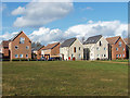
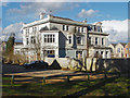
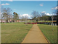
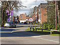
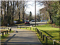
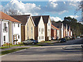
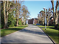
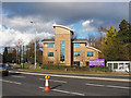
Photos of RG12 9DY

Area Information
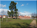
Living in RG12 9DY means residing within a specific postcode cluster in Berkshire, defined by its compact physical footprint. The area covers just 0.003 square kilometres, yet it houses 1,789 residents. This high density of 499,012 people per square kilometre indicates a tightly packed residential environment where neighbours are close by. Despite the small physical size, the location serves as a settled community with established routines. The area sits in England, offering a residential experience characterised by proximity to major transport links and local services. Residents navigate a environment where space is at a premium due to the limited land area. Daily life involves easy access to nearby hubs like Bracknell and Ascot. The concentration of population in such a small space creates a distinct neighbourhood dynamic where facilities are shared efficiently. Homebuyers considering this postcode should understand that they are stepping into a mature, high-density cluster rather than a sprawling village or estate. The layout supports a convenient lifestyle where essential amenities and transport nodes are within practical reach without needing long-distance travel.
- Area Type
- Postcode
- Area Size
- 3585 m²
- Population
- 1789
- Population Density
- 4474 people/km²
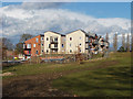
The housing market in RG12 9DY is defined by a strong preference for house ownership. With 67% of households owning their homes, the area leans heavily towards owner-occupiers rather than tenants. Accommodation types are primarily houses, distinguishing this postcode from fratally or apartment-heavy developments often found in denser urban postcodes. This dominance of houses among the 1,789 residents suggests a demand for residential properties with traditional outdoor space. Given the small area size of 3,585 square metres, the supply of homes is concentrated. Buyers looking at RG12 9DY should expect to find a range of residential stock suitable for those seeking ownership. The high ownership rate indicates that the current market is likely driven by existing owners selling or upgrading rather than landlords looking for rental income. This environment often translates to more stable neighbourhood values and a community where residents have a permanent stake in their addresses. The focus on houses rather than flats supports families and individuals who prioritise property ownership in a residential cluster.
House Prices in RG12 9DY
No properties found in this postcode.
Energy Efficiency in RG12 9DY
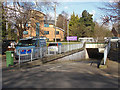
Daily life in RG12 9DY centres on convenient access to essential amenities and transport links. Retail options include five nearby shops, notably Waitrose Little Waitrose Shell, Co-op Easthampstead, and Tesco Bracknell. These venues provide residents with practical grocery and everyday shopping needs within reach. Transport connectivity is supported by five railway stations, with Bracknell Railway Station, Martins Heron Railway Station, and Ascot Railway Station listed as key hubs. Access to these stations allows residents to commute to wider destinations across Berkshire and beyond. The proximity to these specific retail and transport nodes defines the local character. Living near Waitrose and major train stations means that daily errands and commutes do not require excessive travel time. The availability of multiple railway stations ensures flexibility for travel schedules. This blend of retail and rail access provides a solid foundation for a practical, well-connected lifestyle.
Amenities
Schools
Family life in RG12 9DY benefits from access to two distinct educational institutions named Ranelagh School. One operates as a primary school, catering to the early years of compulsory education. The second, also named Ranelagh School, functions as an academy and holds an outstanding Ofsted rating. This outstanding rating signifies a high standard of educational quality and performance within the academy sector. The presence of both a primary establishment and an outstanding-rated academy provides parents with a recognised educational path for their children. While the two schools share a name, they serve different educational stages and operational structures. Families living in this postcode can access these specific named institutions without needing to commute further afield. The mixture of primary and academy provision offers flexibility for those navigating the school system. The outstanding status of the academy is a key factor for any parent evaluating schools near RG12 9DY.
| Rank | School | Type | Entry gender | Ages |
|---|
Explore more schools in this area
Go to Schools tabDemographics
The community demographic profile reveals an established population with a median age of 47 years. Most commonly, the residents fall into the adult age range of 30 to 64 years, suggesting an area dominated by established households rather than young families or retirees. House ownership stands at 67%, indicating that the majority of people living here own their homes outright or through a mortgage. The predominant accommodation type consists of houses, which aligns with the higher ownership rate. The predominant ethnic group is White, reflecting the demographic makeup of the local community. These figures paint a picture of a settled, homeownership-led community where most occupants are in their prime working or early retirement years. The high ownership rate of two-thirds implies stability and a long-term commitment to the locality. Families and professionals constitute the bulk of the 1,789 people calling this small postcode home. This age profile and ownership structure typically correlate with specific local demands, such as spaces for working adults and support for older neighbours.
Household Size
Accommodation Type
Tenure
Ethnic Group
Religion
Household Composition
Age
Household Deprivation
NS-SEC
Explore more demographic insights in this area
Go to Demographics tabPlanning
Planning Constraints
- Flood RiskPremium
- Ramsar Wetland SitesPremium
- Area of Outstanding Natural BeautyPremium
- Protected Nature ReservePremium
- Protected WoodlandPremium