Area Overview for RG12 7ND
Photos of RG12 7ND

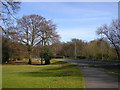
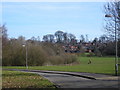
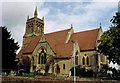
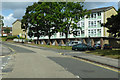
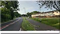
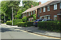
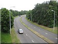
31 photos from this area
Area Information
Key information about the RG12 7ND including its size, population, and administrative classification.
- Area Type
- Postcode
- Area Size
- 8447 m²
- Population
- 1952
- Population Density
- 4141 people/km²
House Prices in RG12 7ND
28
Properties
£179,275
Average Sold Price
£58,000
Lowest Price
£400,000
Highest Price
Showing 28 properties
| Address | Type | Beds | Baths | Last Sale Price | Last Sale Date | |
|---|---|---|---|---|---|---|
| 51 Beckford Avenue, Bracknell, RG12 7ND | house | - | - | £400,000 | Oct 2021 | |
| 1 Beckford Avenue, Bracknell, RG12 7ND | Terraced | 2 | - | £295,000 | Mar 2016 | |
| 45 Beckford Avenue, Bracknell, RG12 7ND | house | - | - | £300,000 | Feb 2016 | |
| 13 Beckford Avenue, Bracknell, RG12 7ND | house | 3 | - | £185,000 | Jan 2012 | |
| 49 Beckford Avenue, Bracknell, RG12 7ND | Terraced | 3 | 1 | £207,000 | Jul 2007 | |
| 37 Beckford Avenue, Bracknell, RG12 7ND | Terraced | - | - | £192,000 | May 2007 | |
| 33 Beckford Avenue, Bracknell, RG12 7ND | house | - | - | £178,500 | Feb 2007 | |
| 39 Beckford Avenue, Bracknell, RG12 7ND | Terraced | 3 | 1 | £137,000 | Feb 2004 | |
| 41 Beckford Avenue, Bracknell, RG12 7ND | house | - | - | £152,950 | Oct 2003 | |
| 29 Beckford Avenue, Bracknell, RG12 7ND | Terraced | - | - | £144,000 | Aug 2002 |
Page 1 of 3
Energy Efficiency in RG12 7ND
Amenities
Schools
| Rank | School | Type | Entry gender | Ages |
|---|
Explore more schools in this area
Go to Schools tabDemographics
Household Size
Family (3-5 people)
most common
Accommodation Type
Houses
most common
Tenure
66
majority
Ethnic Group
White
most common
Religion
N/A
most common
Household Composition
N/A
most common
Age
47
median
Adults (30-64 years)
most common
Household Deprivation
N/A
with no deprivation
NS-SEC
39
in Lower managerial occupations
Explore more demographic insights in this area
Go to Demographics tabPlanning
Planning Constraints
- Flood RiskPremium
- Ramsar Wetland SitesPremium
- Area of Outstanding Natural BeautyPremium
- Protected Nature ReservePremium
- Protected WoodlandPremium