Area Overview for RG12 7HB
Photos of RG12 7HB
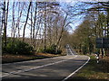

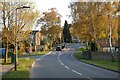
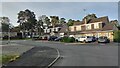
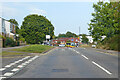
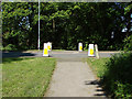
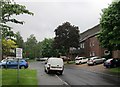
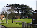
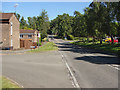
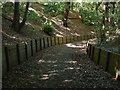

11 photos from this area
Area Information
Key information about the RG12 7HB including its size, population, and administrative classification.
- Area Type
- Postcode
- Area Size
- 7354 m²
- Population
- 1424
- Population Density
- 6792 people/km²
House Prices in RG12 7HB
46
Properties
£149,368
Average Sold Price
£87,000
Lowest Price
£207,500
Highest Price
Showing 46 properties
| Address | Type | Beds | Baths | Last Sale Price | Last Sale Date | |
|---|---|---|---|---|---|---|
| 59 Ladybank, Bracknell, RG12 7HB | Maisonette | 1 | - | £167,000 | Jun 2022 | |
| 66 Ladybank, Bracknell, RG12 7HB | Flat | - | - | £170,000 | Dec 2021 | |
| 85 Ladybank, Bracknell, RG12 7HB | Flat | - | - | £150,000 | Mar 2021 | |
| 50 Ladybank, Bracknell, RG12 7HB | Flat | - | - | £182,500 | Feb 2021 | |
| 55 Ladybank, Bracknell, RG12 7HB | Flat | 1 | 1 | £175,000 | Jun 2019 | |
| 71 Ladybank, Bracknell, RG12 7HB | Flat | - | - | £179,000 | May 2018 | |
| 73 Ladybank, Bracknell, RG12 7HB | Flat | - | - | £207,500 | Sep 2017 | |
| 77 Ladybank, Bracknell, RG12 7HB | Flat | - | - | £190,000 | Aug 2017 | |
| 52 Ladybank, Bracknell, RG12 7HB | Flat | - | - | £173,500 | Jun 2015 | |
| 69 Ladybank, Bracknell, RG12 7HB | Flat | 1 | - | £154,000 | May 2015 |
Page 1 of 5
Energy Efficiency in RG12 7HB
Amenities
Schools
| Rank | School | Type | Entry gender | Ages |
|---|
Explore more schools in this area
Go to Schools tabDemographics
Household Size
Family (3-5 people)
most common
Accommodation Type
Houses
most common
Tenure
59
majority
Ethnic Group
White
most common
Religion
N/A
most common
Household Composition
N/A
most common
Age
47
median
Adults (30-64 years)
most common
Household Deprivation
N/A
with no deprivation
NS-SEC
34
in Lower managerial occupations
Explore more demographic insights in this area
Go to Demographics tabPlanning
Planning Constraints
- Flood RiskPremium
- Ramsar Wetland SitesPremium
- Area of Outstanding Natural BeautyPremium
- Protected Nature ReservePremium
- Protected WoodlandPremium