Area Overview for RG12 7DZ
Photos of RG12 7DZ
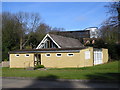
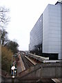
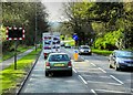
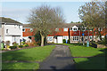
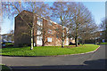
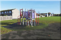
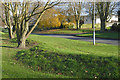
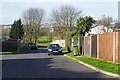
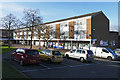
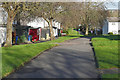
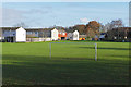
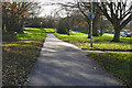
45 photos from this area
Area Information
Key information about the RG12 7DZ including its size, population, and administrative classification.
- Area Type
- Postcode
- Area Size
- 5.4 hectares
- Population
- 1532
- Population Density
- 2713 people/km²
House Prices in RG12 7DZ
38
Properties
£164,557
Average Sold Price
£101,200
Lowest Price
£300,000
Highest Price
Showing 38 properties
| Address | Type | Beds | Baths | Last Sale Price | Last Sale Date | |
|---|---|---|---|---|---|---|
| 3, Cardew Court, Crowthorne Road, Bracknell, RG12 7DZ | Flat | - | - | £285,000 | Dec 2025 | |
| 22, Cardew Court, Crowthorne Road, Bracknell, RG12 7DZ | Flat | - | - | £132,750 | Aug 2025 | |
| 16, Cardew Court, Crowthorne Road, Bracknell, RG12 7DZ | Flat | 2 | - | £135,000 | Aug 2025 | |
| 6, Cardew Court, Crowthorne Road, Bracknell, RG12 7DZ | Flat | - | - | £135,000 | May 2025 | |
| 14, Cardew Court, Crowthorne Road, Bracknell, RG12 7DZ | Flat | - | - | £101,250 | May 2025 | |
| 26, Cardew Court, Crowthorne Road, Bracknell, RG12 7DZ | Flat | - | - | £220,000 | Feb 2025 | |
| 20, Cardew Court, Crowthorne Road, Bracknell, RG12 7DZ | Flat | - | - | £139,500 | Jun 2024 | |
| 4, Cardew Court, Crowthorne Road, Bracknell, RG12 7DZ | Flat | 2 | 1 | £225,000 | May 2024 | |
| 21, Cardew Court, Crowthorne Road, Bracknell, RG12 7DZ | Flat | - | - | £188,500 | Mar 2024 | |
| 19, Cardew Court, Crowthorne Road, Bracknell, RG12 7DZ | Flat | - | - | £141,750 | Jan 2024 |
Page 1 of 4
Energy Efficiency in RG12 7DZ
Amenities
Schools
| Rank | School | Type | Entry gender | Ages |
|---|
Explore more schools in this area
Go to Schools tabDemographics
Household Size
Two person
most common
Accommodation Type
Flats
most common
Tenure
37
majority
Ethnic Group
White
most common
Religion
N/A
most common
Household Composition
N/A
most common
Age
47
median
Adults (30-64 years)
most common
Household Deprivation
N/A
with no deprivation
NS-SEC
42
in Lower managerial occupations
Explore more demographic insights in this area
Go to Demographics tabPlanning
Planning Constraints
- Flood RiskPremium
- Ramsar Wetland SitesPremium
- Area of Outstanding Natural BeautyPremium
- Protected Nature ReservePremium
- Protected WoodlandPremium