Area Overview for RG12 5PZ
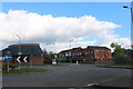
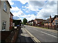
Photos of RG12 5PZ


Area Information
Living in RG12 5PZ means residing within a compact residential cluster defined by the postcode RG12 5PZ. This specific location contains a population of 1,442 people, creating an intimate environment where neighbours are likely to know each other. The area is situated in England, offering a quiet setting that avoids the crowds of larger urban centres. Your daily life here is shaped by a high density of 1,396 people per square kilometre, despite the small overall footprint. Residents enjoy a lifestyle focused on proximity rather than extensive travel, with essential services and transport links placed within practical reach. You will find yourself in a community that values a home-centric existence, where the distinct character of the cluster provides a sense of place without the noise of a bustling street. The area functions as a self-contained hub where you can manage your days without needing to commute far for basic needs. This postcode represents a straightforward choice for those seeking a contained residential experience.
- Area Type
- Postcode
- Area Size
- Not available
- Population
- 1442
- Population Density
- 1396 people/km²
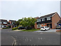
The housing market in RG12 5PZ is characterised by a strong leaning towards owner-occupier status. With 73 per cent of dwellings owned by their residents, this postcode operates very differently from areas dominated by private landlords. The accommodation type is defined by houses, suggesting that detached, semi-detached, or terraced family homes make up the bulk of the stock. This concentration of house ownership means you will find a mature housing stock where replacements and renovations occur gradually rather than through rapid turnover of rental units. For buyers looking at this small area, the high ownership rate signals long-term stability and potentially more valued local assets. The absence of a large rental sector indicates that the demand here is driven by families or couples seeking to settle permanently. You should expect to compete with other owner-bidders if you wish to purchase, rather than bidding against investors looking for rental yield. The market dynamics are calm and predictable, lacking the volatility often seen in mixed-tenure estates.
House Prices in RG12 5PZ
No properties found in this postcode.
Energy Efficiency in RG12 5PZ
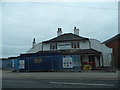
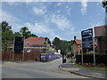
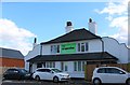
Your lifestyle in RG12 5PZ is supported by a practical network of retail and rail amenities within easy reach. Five retail options are available to you, including The Southern Co-operative Co, Budgens Lightfoots, and a Morrisons Daily. These specific shops provide for immediate grocery needs and daily essentials without requiring a long journey to larger towns. Transport links are equally accessible, with five rail stations nearby including Bracknell Railway Station, Wokingham Railway Station, and Martins Heron Railway Station. You can utilise these stations for commuting to London or travelling to other parts of Berkshire without navigating complex regional maps. The presence of a Morrisons Daily indicates a strongfocus on convenience for your weekly shopping. This combination of retail and rail access ensures that your daily routine is efficient and convenient. You do not need to leave the RG12 area frequently to satisfy your needs for food, transport, or local services. The nearby stations connect you directly to major employment hubs.
Amenities
Schools
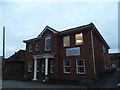
Families residing near RG12 5PZ have access to two distinct educational institutions that serve the immediate vicinity. Newbold School is an independent provision holding an outstanding Ofsted rating. Cressex Lodge School operates as a special school and also commands an outstanding Ofsted rating. The presence of two outstanding-rated institutions provides a secure educational option for children living in this postcode. The mix of independent and special education suggests that you will find schools catering to diverse educational needs and family circumstances within easy reach. Parents choosing schools near RG12 5PZ benefit from options that have achieved the highest regulatory standards. You do not need to look far beyond this local cluster for highly rated learning environments. These specific schools form the primary educational backbone for the residents of this small residential area. Their combined outstanding status removes the anxiety often associated with school attendance and location.
| Rank | School | Type | Entry gender | Ages |
|---|
Explore more schools in this area
Go to Schools tabDemographics
The community in RG12 5PZ is dominated by adults aged between 30 and 64 years. With a median age of 47, the demographic profile suggests a settlement of established families and individuals who have already purchased homes. This age bracket implies stability and a lack of the transient population often found in student or holiday zones. Home ownership stands at a significant 73 per cent, reinforcing the idea that this is a settled neighbourhood where residents plan to stay. The accommodation type consists principally of houses, reflecting the preference for standalone or semi-detached living spaces over flats or terraced housing. Ethnic diversity in this specific cluster is predominantly White, mirroring the broader patterns of the surrounding region. There is no significant transient workforce or temporary accommodation visible in the statistics for this postcode. The high rate of ownership combined with the age profile indicates a stable economic base within the community. You are joining an area where people have put down roots and are unlikely to move quickly.
Household Size
Accommodation Type
Tenure
Ethnic Group
Religion
Household Composition
Age
Household Deprivation
NS-SEC
Explore more demographic insights in this area
Go to Demographics tabPlanning
Planning Constraints
- Flood RiskPremium
- Ramsar Wetland SitesPremium
- Area of Outstanding Natural BeautyPremium
- Protected Nature ReservePremium
- Protected WoodlandPremium