Area Overview for RG12 4BA
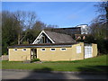
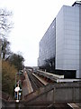
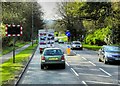
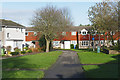
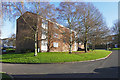
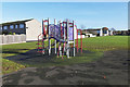
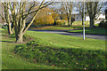
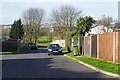
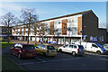
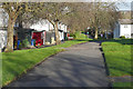
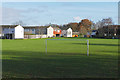
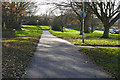
Photos of RG12 4BA
Area Information
Living in RG12 4BA means settling into a specific residential cluster defined by its postcode. This small area holds a population of 2,608 residents, creating an intimate community feel rather than the anonymity found in larger urban districts. The environment focuses on domestic life within a contained setting where neighbours are often close by. Daily routines revolve around the immediate household and nearby facilities rather than distant city centres. The area represents a slice of life outside the broader Bracknell or Ascot metropolitan footprint, offering a quiet retreat from the mainline traffic while maintaining functional access to greater services. Prospective buyers should view RG12 4BA as a contained pocket of housing. The physical layout suggests a neighbourhood designed for settled living rather than rapid transit or commercial hustle. You will find that routine activities, from shopping to walking, happen within short distances. This concentration of homes creates a sense of locality. The area does not offer vast open spaces or complex city infrastructure, but it provides a stable environment for those seeking to remove themselves from the wider noise and pace of regional life. It is a place where the boundaries are clear and the community dynamics are formed by proximity.
- Area Type
- Postcode
- Area Size
- Not available
- Population
- 2608
- Population Density
- 5256 people/km²
The housing stock in RG12 4BA is characterised by a significant reliance on single-family homes. Houses represent the predominant accommodation type available to buyers within this postcode area. This focus on households over apartments or flats signals a preference for larger living spaces and private gardens. You will find that the property market here caters to those requiring traditional domestic layouts rather than high-density urban living. Home ownership accounts for 42% of the total population, which places the area in a balanced position between owner-occupiers and private tenants. This statistic suggests that purchasing a home is a common goal for many residents, yet rental options remain a viable choice for a substantial minority. For buyers, the availability of houses implies a market geared towards larger plots and detached or semi-detailed structures. The market is not dominated by luxury developments or gated communities; instead, it reflects standard suburban housing stock. Understanding this mix helps you gauge whether this location suits your long-term plans to settle down or your need for flexibility within the regional property landscape.
House Prices in RG12 4BA
No properties found in this postcode.
Energy Efficiency in RG12 4BA
Residents of RG12 4BA enjoy immediate access to essential retail outlets and transport links. Five shopping venues are located within practical reach, including Co-op Easthampstead for everyday groceries, Waitrose Little Waitosse Shell for premium provisions, and M&S Hornhill BP for fashion and household goods. These specific stores allow you to run errands without travelling far beyond your immediate neighbourhood. Transport connectivity is reinforced by five nearby railway stations. Bracknell Railway Station, Martins Heron Railway Station, and Ascot Railway Station are key nodes for rail travel. These stations provide the necessary infrastructure for commuting to broader employment centres. Having these amenities nearby ensures that daily life in RG12 4BA remains convenient. You will not need to venture deep into town for basic purchases or for catching a train. The clustering of shops and stations supports a lifestyle where variety and convenience coexist within a modest radius.
Amenities
Schools
Families living in or near RG12 4BA have access to several educational institutions listed in official records. Fox Hill Primary School operates as a primary school and holds a good Ofsted rating, providing a solid foundation for younger children. The Brakenhale School appears in the vicinity as a primary institution, serving the local catchment for that phase of education. For secondary education, The Brakenhale School also functions as an academy with a good Ofsted rating, offering a clear progression path for students. Additionally, Church Hill House Hospital School serves as a special education provider, ensuring educational support for varied needs within the region. This selection of schools indicates a focus on education within the local sphere. The presence of both primary and academy secondary options means parents have multiple choices without needing to travel far. The good ratings assigned to Fox Hill Primary School and The Brakenhale School provide reassurance regarding educational standards. Living in RG12 4BA places you close to these specific educational resources, reducing commute times for school runs. The mix of school types handles different learning requirements, from standard curricula to specialised support.
| Rank | School | Type | Entry gender | Ages |
|---|
Explore more schools in this area
Go to Schools tabDemographics
The community within RG12 4BA is defined by maturity and family stability. The resident base averages 47 years old, placing the median age firmly in middle adulthood. Most common age groups span from 30 to 64 years, indicating a population that has moved beyond early adulthood. This age profile suggests a neighbourhood dominated by established households, retired couples, or families with older children. Home ownership stands at 42%, meaning slightly fewer than half of the residents own their dwellings while the remainder reside in rented accommodation. This split indicates a mixed market where expatriates or younger professionals join long-term owners. The predominant accommodation type consists of houses, which aligns with the age demographic seeking space and permanence. Ethnic diversity reflects the broader national trend, with the White ethnic group forming the majority. Living in RG12 4BA offers a snapshot of established society where residents have likely put down roots over several decades. The demographic structure supports a quiet, stable atmosphere rather than a transient, youthful vibe.
Household Size
Accommodation Type
Tenure
Ethnic Group
Religion
Household Composition
Age
Household Deprivation
NS-SEC
Explore more demographic insights in this area
Go to Demographics tabPlanning
Planning Constraints
- Flood RiskPremium
- Ramsar Wetland SitesPremium
- Area of Outstanding Natural BeautyPremium
- Protected Nature ReservePremium
- Protected WoodlandPremium