Area Overview for RG12 2UW
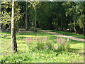
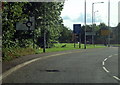
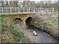
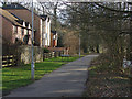
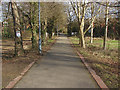
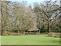
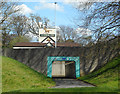
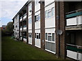
Photos of RG12 2UW


Area Information
RG12 2UW is a specific postcode area covering a small residential cluster of exactly 1.3 hectares. This limited footprint houses 1,886 people, resulting in a population density of 150,861 people per square kilometre. Living in this postcode means residing in a highly concentrated community where neighbours are often next door due to the tight land constraints. The area serves as a compact part of the wider Bracknell landscape, offering a direct residential experience without the sprawling distances associated with larger towns. You will find yourself in a setting that prioritises proximity over space, creating an environment where daily essentials are invariably within a short walk. The scale of RG12 2UW means that local interactions happen frequently, fostering a neighbourhood where community dynamics are visible and immediate. This density distinguishes the area from surrounding zones, defining a lifestyle where public and private spheres overlap constantly. Prospective buyers should recognise that this small footprint dictates the character of the location, offering convenience at the cost of outdoor space. The area represents a focused living solution for those who value central access to amenities above extensive grounds. Understanding this physical reality helps set accurate expectations before viewing homes in RG12 2UW.
- Area Type
- Postcode
- Area Size
- 1.3 hectares
- Population
- 1886
- Population Density
- 3346 people/km²
Homes in RG12 2UW are characterised largely by flat accommodation, which aligns with the specific description of the area's primary dwelling type. With only 52 per cent of residents owning their homes, the market operates as a blend of owner-occupied and rented properties. This lower ownership rate compared to national averages suggests a significant presence of landlords or investors offering rental units to tenants. The accommodation type data confirms that you will mainly encounter apartment-style living rather than traditional suburban homes. For buyers searching for properties in this specific postcode, availability will be restricted by the 1.3-hectare limit of the zone. The density of 150,861 people per square kilometre implies that land is scarce, keeping the total number of available units low. You should expect competition for available flats as the high population count of 1,886 people competes for a limited housing stock. The 52 per cent ownership figure indicates that rental agreements are a common entry point into this neighbourhood. Potential buyers must act quickly when viewing flats, as the small area size limits new developments significantly. Understanding this market dynamic is vital when navigating the purchase process for RG12 2UW.
House Prices in RG12 2UW
No properties found in this postcode.
Energy Efficiency in RG12 2UW
Residents of RG12 2UW enjoy convenient access to practical retail and transport hubs without needing a long commute. Nearby amenities include Budgens Harmans, Morrisons Daily, and Tesco Bracknell for essential shopping requirements within the retail category. You will find five retail outlets and five railway stations within practical reach, including Martins Heron Railway Station, Bracknell Railway Station, and Ascot Railway Station. This concentration of transport nodes allows you to travel to work or leisure destinations via train rather than solely relying on roads. The availability of multiple supermarkets means daily groceries are always accessible by short foot or car journeys. Living in RG12 2UW places you near key commercial centres that support independent living standards. The combination of five notable retail venues and five rail stations creates a lifestyle defined by accessibility and ease. You do not need to venture far to stock your pantry or catch a train to London or Baden-Powell Park. These amenities directly address the needs of the 1,886 people residing in the postcode area. The presence of Morrisons Daily and Tesco Bracknell ensures competitive pricing and a wide range of products are available. This mix of convenience retail and major railway hubs makes the area a practical choice for those valuing time efficiency in their daily routine.
Amenities
Schools
Families considering schools near RG12 2UW have access to Holly Spring Junior School and Holly Spring Primary School. Both institutions serve the educational needs of children living in the immediate vicinity. Holly Spring Primary School holds an Ofsted rating of good, providing assurance of educational quality for prospective parents. The presence of both primary and junior schools within the same name indicates a coordinated educational facility for younger children. Because the area contains 1,886 residents, these schools likely serve a concentrated local population rather than drawing from a wider municipal region. Living in RG12 2UW places children within walking distance of respectable primary education options with recognised standards. The Ofsted rating of good for Holly Spring Primary School is a concrete indicator of performance that parents can trust. There are no comprehensive schools listed in the immediate data, meaning older children will progress to secondary education in nearby towns. This school configuration supports families with young dependents who prioritise local convenience and proven academic records. When evaluating homes in RG12 2UW, verifying travel times to secondary colleges extends beyond the listed primary options. You will find a focused educational cluster designed to support the resident age profile of adults between 30 and 64 years.
| Rank | School | Type | Entry gender | Ages |
|---|
Explore more schools in this area
Go to Schools tabDemographics
The community in RG12 2UW reflects a mature demographic profile, with a median age of 47 years. Most residents fall within the adult bracket of 30 to 64 years, indicating an area populated by working-age individuals and established families rather than young students or retirees. Home ownership stands at 52 per cent, suggesting a balance between owner-occupiers and private tenants within the cluster. The predominant ethnic group is White, which aligns with the broader demographic trends of the region. Accommodation types in this postcode are identified as flats, meaning the housing stock consists primarily of apartment living rather than detached or semi-detached houses. This configuration supports the high population density figure of 150,861 people per square kilometre by maximising units on limited land. You will encounter a stable population structure where long-term residents likely outnumber transient groups. The age distribution suggests a need for healthcare services and leisure facilities suited to middle-aged adults. Crime statistics reinforce the safety of this demographic environment, with the area registering below-average crime rates. The mix of ownership and accommodation type creates a socially diverse household environment where financial backgrounds vary. Understanding these figures helps you assess whether the area fits your specific life stage and housing requirements when considering living in RG12 2UW.
Household Size
Accommodation Type
Tenure
Ethnic Group
Religion
Household Composition
Age
Household Deprivation
NS-SEC
Explore more demographic insights in this area
Go to Demographics tabPlanning
Planning Constraints
- Flood RiskPremium
- Ramsar Wetland SitesPremium
- Area of Outstanding Natural BeautyPremium
- Protected Nature ReservePremium
- Protected WoodlandPremium