Area Overview for RG12 1QW
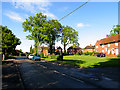
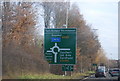
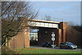
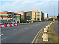
Photos of RG12 1QW


Area Information
Living in RG12 1QW means residing in a specific postcode area covering a small residential cluster within the RG12 Greater Bracknell post towns. This location sits within the RG12 1QW postcode district, offering a focused living environment for a population of 2,078 residents. The community is defined by its compact nature, which concentrates social interaction and local services within a limited geographical footprint. You are looking at a defined slice of the wider Brackneck region, characterised by a tight-knit feel rather than urban sprawl. Daily life here revolves around the immediate neighbours and the few key amenities that surround this residential pocket. The identity of RG12 1QW is shaped by its function as a pure housing cluster. There are no mixed-use commercial hubs or industrial zones within this specific boundary. Instead, the area serves as a bedroom community dependent on nearby town centres for employment and broader leisure activities. The 2,078 people sharing this postcode represent a significant enough community to maintain local cohesion while remaining small enough that services operate at a micro-scale. For a prospective homebuyer, this translates to a living situation where the local character is dictated entirely by the housing stock and the proximity to the railway stations and supermarkets in Bracknell. It is a straightforward residential choice for those prioritising clear boundaries and a contained lifestyle over the anonymity of a larger urban sprawl.
- Area Type
- Postcode
- Area Size
- Not available
- Population
- 2078
- Population Density
- 2635 people/km²
The housing market in RG12 1QW operates within the context of a small residential cluster classified by its postcode status. The area is defined by its function as a pure living space rather than a commercial hub. While specific percentages on home ownership or detailed rental yields are not provided in the local records, the classification as a housing cluster suggests a steady demand for residential properties. The stock in RG12 1QW caters to the 2,078 residents currently recorded in this sector. Potential buyers should view this area as part of the wider RG12 Greater Bracknell continuum. The nature of being a designated residential postcode often correlates with family-oriented housing or long-term tenancies. The absence of industrial or commercial zoning within the immediate boundaries implies that the primary motive for purchasing here is housing. Homes in RG12 1QW are sought by individuals who wish to access the wider Bracknell amenities while living in a more intimate setting. The market dynamics are therefore driven by proximity to the nearest rail stations and retail parks. Understanding the housing stock here requires looking at the broader county trends, as the specific postcodes do not break out unique property types beyond their residential designation.
House Prices in RG12 1QW
No properties found in this postcode.
Energy Efficiency in RG12 1QW
Your daily life in RG12 1QW benefits from immediate access to five key railway stations. You can reach Bracknell Railway Station, Martins Heron Railway Station, and Wokingham Railway Station within practical reach. These transport hubs provide the necessary links to London and other major centres outside the immediate vicinity. The proximity to these three stations makes commuting straightforward and efficient for residents needing to travel beyond the residential cluster. For shopping and essentials, five major retail outlets are situated nearby. Asda Twin, Morrisons Bracknell, and M&S Bracknell BP are among the notable venues within your local network. Having multiple supermarkets and retailers close by reduces the need for long daily trips to town for groceries and household goods. This concentration of retail support enhances the convenience of living in RG12 1QW. You have five specific retail points to choose from for your weekly shopping schedule. The presence of these amenities ensures that you do not feel cut off from standard conveniences despite the postcode's small residential focus.
Amenities
Schools
| Rank | School | Type | Entry gender | Ages |
|---|
Explore more schools in this area
Go to Schools tabDemographics
The community in RG12 1QW comprises exactly 2,078 people. This fixed population number defines the scale of the neighbourhood and the density of local interaction. Because the area covers a small residential cluster, the demographic profile is concentrated and tends to reflect the general composition of the Greater Bracknell post towns that encompass this postcode. The specific breakdown of age groups, household types, or tenure is not explicitly detailed in the local statistics for this micro-area. However, the total population figure indicates a moderate-sized community where services are scaled to roughly 2,000 households. Living in RG12 1QW places you within a group of neighbours who share the challenges and conveniences of a defined postcode sector. The population count suggests a manageable environment where individual households do not outnumber the available local infrastructure. This demographic scale means that community facilities and school placements are drawn from a narrow catchment area averaging around 2,000 residents. Without specific data on age diversity or income levels, the area demonstrates the typical pattern of a suburban estate cluster. The 2,078 figure remains the definitive metric for understanding the size of the community you would join. It represents a stable population base without the extreme volatility seen in larger, mixed-use urban districts.
Household Size
Accommodation Type
Tenure
Ethnic Group
Religion
Household Composition
Age
Household Deprivation
NS-SEC
Explore more demographic insights in this area
Go to Demographics tabPlanning
Planning Constraints
- Flood RiskPremium
- Ramsar Wetland SitesPremium
- Area of Outstanding Natural BeautyPremium
- Protected Nature ReservePremium
- Protected WoodlandPremium