Area Overview for RG10 9TR
Photos of RG10 9TR

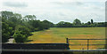
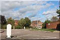
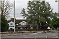
45 photos from this area
Area Information
Key information about the RG10 9TR including its size, population, and administrative classification.
- Area Type
- Postcode
- Area Size
- 10.0 hectares
- Population
- 1526
- Population Density
- 2196 people/km²
House Prices in RG10 9TR
38
Properties
£513,326
Average Sold Price
£101,000
Lowest Price
£900,000
Highest Price
Showing 38 properties
| Address | Type | Beds | Baths | Last Sale Price | Last Sale Date | |
|---|---|---|---|---|---|---|
| Mayfair, Park Lane, Charvil, RG10 9TR | Detached | 4 | 2 | £880,000 | Jan 2025 | |
| 5 Park Lane, Charvil, RG10 9TR | Semi-detached | 4 | 2 | £640,000 | Oct 2024 | |
| 3 Park Lane, Charvil, RG10 9TR | Semi-detached | 3 | - | £729,200 | Jul 2024 | |
| Iffleigh, Park Lane, Charvil, RG10 9TR | house | - | - | £485,000 | May 2021 | |
| Homelands, Park Lane, Charvil, RG10 9TR | Detached | 5 | 4 | £900,000 | Sep 2020 | |
| 11 Park Lane, Charvil, RG10 9TR | Bungalow | 3 | 1 | £750,000 | Sep 2018 | |
| 2 Park Lane, Charvil, RG10 9TR | house | 3 | 1 | £486,000 | Feb 2018 | |
| Springfield, Park Lane, Charvil, RG10 9TR | Semi-detached | 3 | 1 | £452,000 | Aug 2015 | |
| Vine House, Park Lane, Charvil, RG10 9TR | Detached | 4 | 2 | £540,000 | Sep 2012 | |
| Newstead, Park Lane, Charvil, RG10 9TR | house | 4 | - | £568,500 | May 2011 |
Page 1 of 4
Energy Efficiency in RG10 9TR
Amenities
Schools
| Rank | School | Type | Entry gender | Ages |
|---|
Explore more schools in this area
Go to Schools tabDemographics
Household Size
Family (3-5 people)
most common
Accommodation Type
Houses
most common
Tenure
79
majority
Ethnic Group
White
most common
Religion
N/A
most common
Household Composition
N/A
most common
Age
47
median
Adults (30-64 years)
most common
Household Deprivation
N/A
with no deprivation
NS-SEC
50
in Lower managerial occupations
Explore more demographic insights in this area
Go to Demographics tabPlanning
Planning Constraints
- Flood RiskPremium
- Ramsar Wetland SitesPremium
- Area of Outstanding Natural BeautyPremium
- Protected Nature ReservePremium
- Protected WoodlandPremium