Area Overview for RG10 9ST
Photos of RG10 9ST
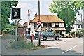
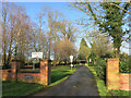
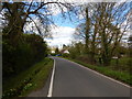
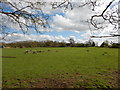
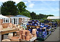
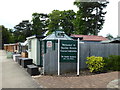
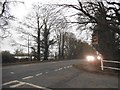
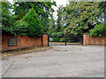
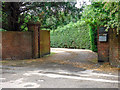
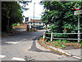

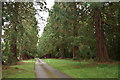
23 photos from this area
Area Information
Key information about the RG10 9ST including its size, population, and administrative classification.
- Area Type
- Postcode
- Area Size
- 28.5 hectares
- Population
- 1442
- Population Density
- 163 people/km²
House Prices in RG10 9ST
11
Properties
£793,000
Average Sold Price
£585,000
Lowest Price
£1,150,000
Highest Price
Showing 11 properties
| Address | Type | Beds | Baths | Last Sale Price | Last Sale Date | |
|---|---|---|---|---|---|---|
| Jasamine Cottage, Tag Lane, Hare Hatch, RG10 9ST | Semi-detached | 3 | 1 | £585,000 | Jun 2024 | |
| Apple Tree Cottage, Tag Lane, Hare Hatch, RG10 9ST | Detached | - | - | £755,000 | Aug 2002 | |
| The Oaks, Tag Lane, Hare Hatch, RG10 9ST | Detached | - | - | £800,000 | Apr 2002 | |
| Shelleys, Tag Lane, Hare Hatch, RG10 9ST | house | - | - | £1,150,000 | Sep 2000 | |
| Kingswood House, Tag Lane, Hare Hatch, RG10 9ST | Detached | - | - | £675,000 | May 1996 | |
| Tennis 71M From Kingswood House, Tag Lane 28M From Unnamed Road, Tag Lane, Hare Hatch, RG10 9ST | Leisure | - | - | - | - | |
| Kingswood Stables, Tag Lane, Hare Hatch, RG10 9ST | Equestrian | - | - | - | - | |
| Tag Lane Bungalow, Tag Lane, Hare Hatch, RG10 9ST | Detached | - | - | - | - | |
| Shinglebury, Tag Lane, Hare Hatch, RG10 9ST | Detached | - | - | - | - | |
| Spring Cottage, Tag Lane, Hare Hatch, RG10 9ST | Semi-detached | - | - | - | - |
Page 1 of 2
Energy Efficiency in RG10 9ST
Amenities
Schools
| Rank | School | Type | Entry gender | Ages |
|---|
Explore more schools in this area
Go to Schools tabDemographics
Household Size
Two person
most common
Accommodation Type
Houses
most common
Tenure
68
majority
Ethnic Group
White
most common
Religion
N/A
most common
Household Composition
N/A
most common
Age
47
median
Adults (30-64 years)
most common
Household Deprivation
N/A
with no deprivation
NS-SEC
46
in Lower managerial occupations
Explore more demographic insights in this area
Go to Demographics tabPlanning
Planning Constraints
- Flood RiskPremium
- Ramsar Wetland SitesPremium
- Area of Outstanding Natural BeautyPremium
- Protected Nature ReservePremium
- Protected WoodlandPremium