Area Overview for RG10 0RR
Photos of RG10 0RR
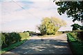
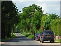
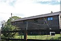
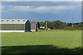
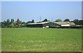
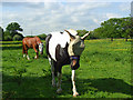
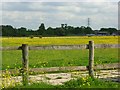
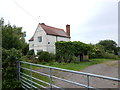
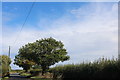
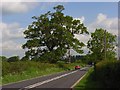
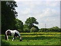
14 photos from this area
Area Information
Key information about the RG10 0RR including its size, population, and administrative classification.
- Area Type
- Postcode
- Area Size
- 48.9 hectares
- Population
- 1474
- Population Density
- 88 people/km²
House Prices in RG10 0RR
32
Properties
£946,667
Average Sold Price
£315,000
Lowest Price
£1,555,000
Highest Price
Showing 32 properties
| Address | Type | Beds | Baths | Last Sale Price | Last Sale Date | |
|---|---|---|---|---|---|---|
| Nelsons Orchard, Nelsons Lane, Hurst, RG10 0RR | Detached | 4 | 2 | £850,000 | Jun 2023 | |
| Knowlands, Nelsons Lane, Hurst, RG10 0RR | Detached | 4 | - | £1,495,000 | Aug 2022 | |
| Nicholas House, Nelsons Lane, Hurst, RG10 0RR | Detached | 5 | 4 | £1,555,000 | Aug 2022 | |
| 1 Nelsons Lane, Hurst, RG10 0RR | Detached | 5 | 4 | £635,000 | Aug 2015 | |
| Abbots Lodge, Nelsons Lane, Hurst, RG10 0RR | house | - | - | £830,000 | Jan 2010 | |
| 2 Nelsons Lane, Hurst, RG10 0RR | Equestrian | 5 | - | £315,000 | Oct 1997 | |
| The Phoenix, Phoenix Park, Nelsons Lane, Hurst, RG10 0RR | Bungalow | 4 | - | - | - | |
| Mobile Home, Magpies, Nelsons Lane, Hurst, RG10 0RR | Mobile Home | - | - | - | - | |
| Annexe, 1 Nelsons Lane, Hurst, RG10 0RR | Unknown | - | - | - | - | |
| Blackthorns, Nelsons Lane, Hurst, RG10 0RR | Mobile Home | - | - | - | - |
Page 1 of 4
Energy Efficiency in RG10 0RR
Amenities
Schools
| Rank | School | Type | Entry gender | Ages |
|---|
Explore more schools in this area
Go to Schools tabDemographics
Household Size
Two person
most common
Accommodation Type
Houses
most common
Tenure
71
majority
Ethnic Group
White
most common
Religion
N/A
most common
Household Composition
N/A
most common
Age
47
median
Adults (30-64 years)
most common
Household Deprivation
N/A
with no deprivation
NS-SEC
50
in Lower managerial occupations
Explore more demographic insights in this area
Go to Demographics tabPlanning
Planning Constraints
- Flood RiskPremium
- Ramsar Wetland SitesPremium
- Area of Outstanding Natural BeautyPremium
- Protected Nature ReservePremium
- Protected WoodlandPremium