Area Overview for RG1 6DG
Photos of RG1 6DG
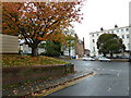
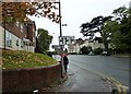
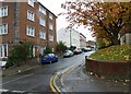
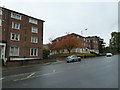


100 photos from this area
Area Information
Key information about the RG1 6DG including its size, population, and administrative classification.
- Area Type
- Postcode
- Area Size
- 8689 m²
- Population
- 1473
- Population Density
- 1466 people/km²
House Prices in RG1 6DG
26
Properties
£294,037
Average Sold Price
£84,950
Lowest Price
£612,500
Highest Price
Showing 26 properties
| Address | Type | Beds | Baths | Last Sale Price | Last Sale Date | |
|---|---|---|---|---|---|---|
| 11 Holybrook Road, Reading, RG1 6DG | house | 1 | 1 | £612,500 | Jan 2023 | |
| 51 Holybrook Road, Reading, RG1 6DG | Semi-detached | 4 | - | £556,500 | Jun 2021 | |
| 13 Holybrook Road, Reading, RG1 6DG | house | 3 | 1 | £254,000 | Nov 2019 | |
| 23 Holybrook Road, Reading, RG1 6DG | Semi-detached | 3 | 1 | £335,000 | Sep 2019 | |
| 15 Holybrook Road, Reading, RG1 6DG | house | - | - | £349,775 | Apr 2019 | |
| 7 Holybrook Road, Reading, RG1 6DG | Semi-detached | 3 | 2 | £325,000 | Aug 2015 | |
| 3 Holybrook Road, Reading, RG1 6DG | house | 1 | 1 | £219,950 | Apr 2010 | |
| 39 Holybrook Road, Reading, RG1 6DG | Semi-detached | 3 | 1 | £276,000 | Dec 2006 | |
| 37 Holybrook Road, Reading, RG1 6DG | Semi-detached | - | - | £309,950 | Nov 2006 | |
| 27 Holybrook Road, Reading, RG1 6DG | house | - | - | £183,950 | Jan 2003 |
Page 1 of 3
Energy Efficiency in RG1 6DG
Amenities
Schools
| Rank | School | Type | Entry gender | Ages |
|---|
Explore more schools in this area
Go to Schools tabDemographics
Household Size
Two person
most common
Accommodation Type
Houses
most common
Tenure
65
majority
Ethnic Group
White
most common
Religion
N/A
most common
Household Composition
N/A
most common
Age
47
median
Adults (30-64 years)
most common
Household Deprivation
N/A
with no deprivation
NS-SEC
36
in Lower managerial occupations
Explore more demographic insights in this area
Go to Demographics tabPlanning
Planning Constraints
- Flood RiskPremium
- Ramsar Wetland SitesPremium
- Area of Outstanding Natural BeautyPremium
- Protected Nature ReservePremium
- Protected WoodlandPremium