Area Overview for RG1 6DA
Photos of RG1 6DA


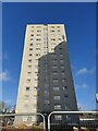

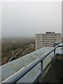


79 photos from this area
Area Information
Key information about the RG1 6DA including its size, population, and administrative classification.
- Area Type
- Postcode
- Area Size
- 19.5 hectares
- Population
- 1473
- Population Density
- 1466 people/km²
House Prices in RG1 6DA
40
Properties
£233,001
Average Sold Price
£35,235
Lowest Price
£420,000
Highest Price
Showing 40 properties
| Address | Type | Beds | Baths | Last Sale Price | Last Sale Date | |
|---|---|---|---|---|---|---|
| 40 Yew Lane, Reading, RG1 6DA | Terraced | 2 | 1 | £420,000 | Feb 2025 | |
| 30 Yew Lane, Reading, RG1 6DA | Flat | - | - | £242,000 | May 2024 | |
| 17 Yew Lane, Reading, RG1 6DA | Terraced | 2 | 1 | £335,000 | Feb 2024 | |
| 1 Yew Lane, Reading, RG1 6DA | Cottage | 2 | 1 | £415,000 | Aug 2022 | |
| 36 Yew Lane, Reading, RG1 6DA | Retail | 3 | 2 | £390,000 | Apr 2022 | |
| 5 Yew Lane, Reading, RG1 6DA | Terraced | 2 | 1 | £265,000 | Dec 2021 | |
| 18 Yew Lane, Reading, RG1 6DA | house | - | - | £300,000 | Jun 2021 | |
| 22 Yew Lane, Reading, RG1 6DA | Maisonette | 1 | - | £220,000 | Mar 2021 | |
| 14 Yew Lane, Reading, RG1 6DA | Terraced | 2 | 1 | £290,000 | Jul 2020 | |
| 7 Yew Lane, Reading, RG1 6DA | Maisonette | 1 | 1 | £200,000 | Oct 2019 |
Page 1 of 4
Energy Efficiency in RG1 6DA
Amenities
Schools
| Rank | School | Type | Entry gender | Ages |
|---|
Explore more schools in this area
Go to Schools tabDemographics
Household Size
Two person
most common
Accommodation Type
Houses
most common
Tenure
65
majority
Ethnic Group
White
most common
Religion
N/A
most common
Household Composition
N/A
most common
Age
47
median
Adults (30-64 years)
most common
Household Deprivation
N/A
with no deprivation
NS-SEC
36
in Lower managerial occupations
Explore more demographic insights in this area
Go to Demographics tabPlanning
Planning Constraints
- Flood RiskPremium
- Ramsar Wetland SitesPremium
- Area of Outstanding Natural BeautyPremium
- Protected Nature ReservePremium
- Protected WoodlandPremium