Area Overview for RG1 5SE
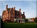
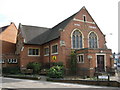
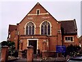
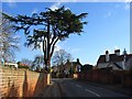
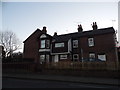
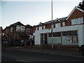
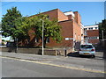
Photos of RG1 5SE

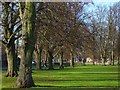
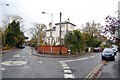
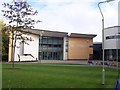
Area Information
RG1 5SE represents a compact residential cluster within the broader Reading postcodes, covering exactly 4,008 square metres. This small geographic footprint houses 1,608 people, creating a tightly knit environment where neighbours are likely to know one another. Although the area size is minute, the population density figures indicate a significant concentration of residents in this specific postcode sector. Living in RG1 5SE means you occupy a space that is part of a larger urban fabric yet retains the characteristics of a defined residential zone. The area functions as a specific postcode area covering a small residential cluster rather than a sprawling district with varied land uses. Your daily life here is shaped by the immediate proximity to essential services and the density of the local community.
- Area Type
- Postcode
- Area Size
- 4008 m²
- Population
- 1608
- Population Density
- 11437 people/km²
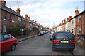
Homes in RG1 5SE are primarily Houses, forming the main accommodation type for the 1,608 residents. The home ownership figure of 36% indicates that this is a market with a substantial rental sector alongside owner-occupied stock. Prospective buyers looking at this small area should anticipate a mix of properties suitable for young adults, given the demographic makeup. The low ownership rate contrasts with areas where multi-generational families dominate the market. You will find that the housing stock here is designed for living in a high-density, young-adult focused environment. The specific postcode area covering this small residential cluster suggests limited stock, making individual purchases potentially competitive if supply is low.
House Prices in RG1 5SE
Showing 9 properties
| Address | Type | Beds | Baths | Last Sale Price | Last Sale Date | |
|---|---|---|---|---|---|---|
| 50 Eastern Avenue, Reading, RG1 5SE | Semi-detached | 3 | - | £342,500 | May 2013 | |
| 60A Eastern Avenue, Reading, RG1 5SE | house | 4 | - | £250,000 | Jun 2009 | |
| 56 Eastern Avenue, Reading, RG1 5SE | Semi-detached | - | - | £247,950 | Sep 2006 | |
| 54 Eastern Avenue, Reading, RG1 5SE | Detached | - | - | £315,000 | Aug 2006 | |
| 52 Eastern Avenue, Reading, RG1 5SE | Semi-detached | - | - | £85,000 | Apr 1996 | |
| 58C Eastern Avenue, Reading, RG1 5SE | Detached | 3 | 1 | - | - | |
| 58 Eastern Avenue, Reading, RG1 5SE | house | - | - | - | - | |
| 58B Eastern Avenue, Reading, RG1 5SE | house | - | - | - | - | |
| 58A Eastern Avenue, Reading, RG1 5SE | Semi-detached | - | - | - | - |
Energy Efficiency in RG1 5SE
Residents of RG1 5SE enjoy convenient access to retail and rail networks within practical reach. Co-op Erleigh, Tesco Reading, and Co-op London are among the five notable retail spots serving the area. You can access these shops for everyday necessities, groceries, and household items without travelling far. Transport links are equally strong, with five rail stations nearby including Reading Railway Station, Earley Railway Station, and Reading West Railway Station. These five stations provide direct access to the wider rail network, making commuting easier. The combination of multiple supermarket options and several train stations ensures that daily life involves minimal travel friction for those living in RG1 5SE.
Amenities
Schools
Families living in RG1 5SE have access to several educational institutions nearby. Redlands Primary School is identified as a primary school with an Ofsted rating of satisfactory. For independent education, St Joseph's College and St Joseph's Convent Preparatory School are located near the area. This mix of state and independent options provides flexibility for parents choosing an education path. The presence of St Joseph's College and St Joseph's Convent Preparatory School suggests a range of fee-paying options close to RG1 5SE. However, Redlands Primary School remains a key option for those seeking state education with a satisfactory regulatory assessment.
| Rank | School | Type | Entry gender | Ages |
|---|
Explore more schools in this area
Go to Schools tabDemographics
The community profile for RG1 5SE is distinctly young, with a median age of 22 years. Most Common Age Range data shows that the population is dominated by Young Adults aged 15 to 29 years. This demographic skew suggests the area attracts students, early-career professionals, or young families rather than older retirees. Home ownership sits at 36%, meaning the majority of residents likely rent or are in the early stages of a property ladder. Houses form the predominant accommodation type, offering single-family living within this smaller postcode boundary. Ethnic diversity is primarily White, which reflects the broader settlement patterns of the region. Residents can expect a community where household budgets may lean towards renting given the ownership statistics.
Household Size
Accommodation Type
Tenure
Ethnic Group
Religion
Household Composition
Age
Household Deprivation
NS-SEC
Explore more demographic insights in this area
Go to Demographics tabPlanning
Planning Constraints
- Flood RiskPremium
- Ramsar Wetland SitesPremium
- Area of Outstanding Natural BeautyPremium
- Protected Nature ReservePremium
- Protected WoodlandPremium