Area Overview for RG1 5DU
Photos of RG1 5DU

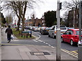
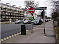

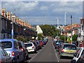
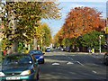
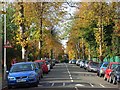
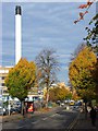
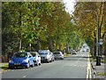
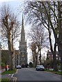
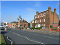
100 photos from this area
Area Information
Key information about the RG1 5DU including its size, population, and administrative classification.
- Area Type
- Postcode
- Area Size
- 3.3 hectares
- Population
- 1690
- Population Density
- 10368 people/km²
House Prices in RG1 5DU
56
Properties
£695,000
Average Sold Price
£320,000
Lowest Price
£900,000
Highest Price
Showing 56 properties
| Address | Type | Beds | Baths | Last Sale Price | Last Sale Date | |
|---|---|---|---|---|---|---|
| 37 Kendrick Road, Reading, RG1 5DU | Detached | 4 | 2 | £900,000 | Jul 2025 | |
| 35 Kendrick Road, Reading, RG1 5DU | Semi-detached | 5 | 2 | £855,000 | May 2024 | |
| 31 Kendrick Road, Reading, RG1 5DU | house | 5 | - | £875,000 | Sep 2022 | |
| 41 Kendrick Road, Reading, RG1 5DU | Semi-detached | 4 | 2 | £725,000 | Jul 2022 | |
| 33 Kendrick Road, Reading, RG1 5DU | Semi-detached | 1 | 1 | £740,000 | Dec 2018 | |
| Ashfield, 5 Kendrick Road, Reading, RG1 5DU | house | 2 | 2 | £450,000 | Jun 2010 | |
| 39 Kendrick Road, Reading, RG1 5DU | Semi-detached | 1 | - | £320,000 | Apr 2009 | |
| Flat 5, 1 Kendrick Road, Reading, RG1 5DU | Flat | 2 | 1 | - | - | |
| Flat 1, 3 Kendrick Road, Reading, RG1 5DU | Flat | 2 | 2 | - | - | |
| Flat 8, 3 Kendrick Road, Reading, RG1 5DU | Flat | 2 | - | - | - |
Page 1 of 6
Energy Efficiency in RG1 5DU
Amenities
Schools
| Rank | School | Type | Entry gender | Ages |
|---|
Explore more schools in this area
Go to Schools tabDemographics
Household Size
One person
most common
Accommodation Type
Flats
most common
Tenure
22
majority
Ethnic Group
White
most common
Religion
N/A
most common
Household Composition
N/A
most common
Age
22
median
Young Adults (15-29 years)
most common
Household Deprivation
N/A
with no deprivation
NS-SEC
33
in Lower managerial occupations
Explore more demographic insights in this area
Go to Demographics tabPlanning
Planning Constraints
- Flood RiskPremium
- Ramsar Wetland SitesPremium
- Area of Outstanding Natural BeautyPremium
- Protected Nature ReservePremium
- Protected WoodlandPremium