Area Overview for RG1 5DP
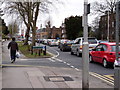
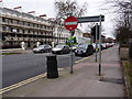
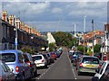
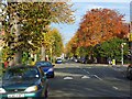
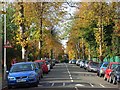
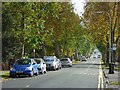
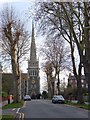
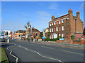
Photos of RG1 5DP


Area Information
Living in RG1 5DP offers a distinct experience within the Reading postcode cluster. This specific area covers just 6208 square metres of land and is home to a population of 1877 people. The density here is exceptionally high, reaching 302354 people per square kilometre. You will find yourself in a tight-knit residential environment where houses dominate the street scene. The community is characterised by older buildings and established streets rather than new developments. Daily life revolves around proximity to local hubs, with essential services and transport links nearby. Residents value the convenience of having significant amenities within practical reach, including major rail stations and large retail stores. The area caters primarily to adults seeking a settled home life. While the physical space is compact, the location provides straightforward access to the wider borough. Homebuyers here appreciate the straightforward layout and the clear definition of the residential zone.
- Area Type
- Postcode
- Area Size
- 6208 m²
- Population
- 1877
- Population Density
- 7129 people/km²
The housing stock in RG1 5DP is exclusively composed of houses, with no flats or apartments listed for this cluster. This uniformity shapes the local market and offers a consistent living experience for buyers. However, property tenure is dominated by renting rather than ownership.仅有 35% of residents own their homes, meaning you are likely to encounter a renter-heavy environment if you engage with local agents. This low ownership percentage often signals a competitive rental market or a high turnover of tenancies. For buyers looking to purchase, this area presents an opportunity to acquire a traditional house in a dense residential cluster. The concentration of owner-occupied homes is relatively low compared to older suburban estates in Reading. You should assess whether the lower ownership rate affects long-term stability or rental pressure in the immediate vicinity.
House Prices in RG1 5DP
Showing 8 properties
| Address | Type | Beds | Baths | Last Sale Price | Last Sale Date | |
|---|---|---|---|---|---|---|
| 124 Kendrick Road, Reading, RG1 5DP | Detached | 3 | 1 | £450,000 | May 2023 | |
| 120 Kendrick Road, Reading, RG1 5DP | Semi-detached | 3 | 1 | £301,000 | May 2014 | |
| 114 Kendrick Road, Reading, RG1 5DP | Detached | 1 | - | £530,000 | Aug 2013 | |
| 112A Kendrick Road, Reading, RG1 5DP | Semi-detached | 1 | 1 | £385,000 | Mar 2013 | |
| 112 Kendrick Road, Reading, RG1 5DP | house | - | - | £700,000 | Jun 2011 | |
| 116 Kendrick Road, Reading, RG1 5DP | Detached | 3 | 1 | - | - | |
| 122 Kendrick Road, Reading, RG1 5DP | house | - | - | - | - | |
| 118 Kendrick Road, Reading, RG1 5DP | Semi-detached | 3 | - | - | - |
Energy Efficiency in RG1 5DP
Residents of RG1 5DP enjoy convenient access to major shopping and travel hubs without needing a journey into the countryside. Retail options include Tesco Reading, M&S Royal Berkshire Hosp SF, and Tesco Crown. These five retail locations provide comprehensive supermarkets and daily necessities within easy reach. Public transport is equally accessible, with Reading Railway Station, Reading West Railway Station, and Earley Railway Station nearby. This network of five rail stations allows quick access to Reading and beyond. Daily life combines modern convenience with a residential setting. You can shop at large stores and travel without leaving the immediate neighbourhood. The presence of these specific chains ensures you have familiar brands and high-quality groceries available. This accessibility is a key advantage for anyone considering homes in this postcode cluster.
Amenities
Schools
Families residing in or near RG1 5DP have access to several educational institutions. George Palmer Junior School stands as a primary school option for older children in the area. Families with younger infants can attend George Palmer Infant and Nursery School, which covers the early years. Those seeking an independent education option have Christchurch Gardens Kindergarten available. Special educational needs are supported by The Avenue Special School nearby. This mix of state primary, independent nursery, and special provision schools indicates diverse educational pathways. While most facilities are state-run, the presence of the independent kindergarten suggests some parental choice for early education. Buyers should check transport links to these specific locations to determine daily commute times. The concentration of schools suggests that family households may be a growing segment despite the current median age.
| Rank | School | Type | Entry gender | Ages |
|---|
Explore more schools in this area
Go to Schools tabDemographics
The community structure in RG1 5DP is defined by a mature population. The median age stands at 47 years, reflecting a shift away from younger families. Most residents fall into the adult age range of 30 to 64 years. This demographic profile suggests a neighbourhood dominated by established professionals or those nearing retirement. House ownership remains a minority arrangement, with only 35% of households owning their homes outright. The remaining majority likely relies on rental markets or other tenure arrangements. Houses form the primary accommodation type across this postcode sector. The population is predominantly White, representing the main ethnic group in the area. Understanding these figures helps you gauge the character of the street. You can expect a quiet environment where neighbours are often past the peak years of young children. The low ownership rate indicates a mixed tenure landscape where landlords may coexist with owner-occupiers.
Household Size
Accommodation Type
Tenure
Ethnic Group
Religion
Household Composition
Age
Household Deprivation
NS-SEC
Explore more demographic insights in this area
Go to Demographics tabPlanning
Planning Constraints
- Flood RiskPremium
- Ramsar Wetland SitesPremium
- Area of Outstanding Natural BeautyPremium
- Protected Nature ReservePremium
- Protected WoodlandPremium