Area Overview for RG1 4ER
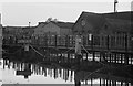
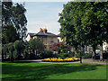
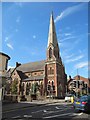
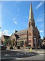
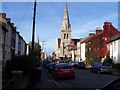
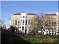
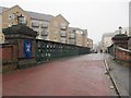
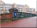
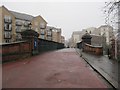
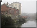
Photos of RG1 4ER


Area Information
RG1 4ER stands as a defined postcode sector within Berkshire, representing a specific residential cluster centred around Reading. The total population of this zone is 2,450 people, creating a tightly knit community rather than a sprawling suburb. Living in RG1 4ER means existing within a population density that fosters distinct neighbourly interactions while retaining access to the wider Reading network. The area is not a sprawling expanse but a focused collection of dwellings where daily life revolves around the immediate cluster and its nearest transport links. This specific postcode serves as a gateway for those seeking a contained housing option close to major rail arteries. The demographic heart of RG1 4ER consists largely of adults aged 30 to 64 years, indicating a maturity that often correlates with established housing stock or professional households. Buyers visiting this location will find a setting that functions as a quiet pocket of residential stability. The character of the area is shaped entirely by its residents and their proximity to key amenities and infrastructure meeting points.
- Area Type
- Postcode
- Area Size
- Not available
- Population
- 2450
- Population Density
- 7143 people/km²
The property market in RG1 4ER is characterised by a high volume of rental properties and a smaller proportion of owner-occupied homes. With home ownership levels currently at 23%, the local market serves more than 75% of residents as a rental sector. Flats constitute the main accommodation type available within this postcode cluster, meaning buyers looking for these specific units should expect strong competition in the rental space. This skew towards flats and rentals suggests the area attracts tenants rather than families seeking to buy large, detached homes. For a potential homebuyer, securing a property in RG1 4ER often requires navigating a market where availability fluctuates based on investor portfolios and corporate tenancies. The low ownership percentage implies that vacant units may cycle through the market frequently as tenants relocate. Consequently, investors or landlords may find opportunities here that differ from buyer-led suburbs. Understanding that flats are the dominant stock type is essential when assessing value or suitability for a specific household need. The market dynamics here reflect the needs of the 30 to 64 age demographic prevalent in the area.
House Prices in RG1 4ER
No properties found in this postcode.
Energy Efficiency in RG1 4ER
Residents of RG1 4ER benefit from a curated range of amenities within practical travelling distance. Five retail locations are noted nearby, including M&S Royal Berkshire Hosp SF, Tesco Reading, and Co-op London. These supermarkets provide essential shopping and weekly provisions close to the residential cluster. For commuters and visitors, five railway connections are available, with Reading Railway Station, Reading West Railway Station, and Earley Railway Station serving as key departure points. This concentration of transport infrastructure links the postcode to the wider regional network efficiently. Daily life involves accessing these specific chain stores and transit hubs for errands, work travel, and social occasions. The proximity of Tesco and M&S ensures that grocery shopping does not require a significant journey outside the immediate area. While the area is residential by nature, the presence of these retail and rail entities creates a convenient, self-sustaining environment for average daily requirements. There are no parks, leisure centres, or fine dining venues named in the data, so leisure pursuits rely on the broader Reading environs.
Amenities
Schools
Families considering RG 1 4ER have access to two primary schools in the immediate vicinity. St John's CofE (Aided) Primary School serves as a local educational option for younger children. Nearby, St John's Church of England Primary School operates with a Good Ofsted rating, offering a reassurance of educational quality for parents in the area. These institutions are the only specific schools listed for the RG1 4ER cluster, limiting choices strictly to this primary sector based on available data. There are no secondary schools, colleges, or further education centres named or rated in the provided information for this specific postcode. The availability of a primary school with a Good rating indicates a functional local provision for early education. Families must look beyond this postcode to find secondary school options, as none are detailed within the immediate sphere of RG1 4ER. The presence of two primary schools suggests a modest provision for school-age children within the 2,450-person population. Prospective residents should verify school catchment boundaries carefully, as the options remain limited to these two named institutions.
| Rank | School | Type | Entry gender | Ages |
|---|
Explore more schools in this area
Go to Schools tabDemographics
The community profile of RG1 4ER reflects a mature demographic with a median age of 47. The most common age range for residents falls between 30 and 64 years, suggesting a population dominated by working-age adults and families rather than young children or elderly singles. Home ownership stands at 23%, indicating that roughly a quarter of residents own their properties outright or with a mortgage. The remaining three-quarters of the population reside in rented accommodation, which points to a significant rental market presence alongside the smaller owner-occupied segment. Flats form the predominant accommodation type in this zone, distinguishing it from areas dominated by detached or semi-detached houses. The predominant ethnic group is White, mirroring the broader Berkshire national trend. Living in RG1 4ER typically involves engaging with an adult-focused community where rental arrangements are common. This housing mix often attracts professionals or those seeking flexible living arrangements near the local stations and retail hubs. The demographic data paints a picture of a stable, adult-led neighbourhood without a large concentration of children.
Household Size
Accommodation Type
Tenure
Ethnic Group
Religion
Household Composition
Age
Household Deprivation
NS-SEC
Explore more demographic insights in this area
Go to Demographics tabPlanning
Planning Constraints
- Flood RiskPremium
- Ramsar Wetland SitesPremium
- Area of Outstanding Natural BeautyPremium
- Protected Nature ReservePremium
- Protected WoodlandPremium