Area Overview for RG1 3NY
Photos of RG1 3NY

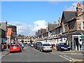
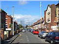
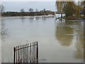

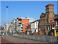

100 photos from this area
Area Information
Key information about the RG1 3NY including its size, population, and administrative classification.
- Area Type
- Postcode
- Area Size
- 7359 m²
- Population
- 1603
- Population Density
- 4130 people/km²
House Prices in RG1 3NY
30
Properties
£272,390
Average Sold Price
£102,000
Lowest Price
£640,000
Highest Price
Showing 30 properties
| Address | Type | Beds | Baths | Last Sale Price | Last Sale Date | |
|---|---|---|---|---|---|---|
| 239 London Road, Reading, RG1 3NY | Terraced | 9 | 3 | £640,000 | Jul 2023 | |
| 227A London Road, Reading, RG1 3NY | Unknown | - | - | £330,000 | Feb 2015 | |
| 245 London Road, Reading, RG1 3NY | Terraced | 4 | 1 | £140,000 | Aug 2005 | |
| 247 London Road, Reading, RG1 3NY | Terraced | 5 | 2 | £149,950 | Nov 2003 | |
| 249 London Road, Reading, RG1 3NY | Terraced | 3 | - | £102,000 | Aug 2000 | |
| 231 London Road, Reading, RG1 3NY | Leisure | - | - | - | - | |
| 221B London Road, Reading, RG1 3NY | Semi-detached | 1 | 1 | - | - | |
| Verwin Plumbing, 223 London Road, Reading, RG1 3NY | Office | - | - | - | - | |
| 241 London Road, Reading, RG1 3NY | Terraced | 5 | 2 | - | - | |
| Riaz Sweet Centre, 217 London Road, Reading, RG1 3NY | shop | - | - | - | - |
Page 1 of 3
Energy Efficiency in RG1 3NY
Amenities
Schools
| Rank | School | Type | Entry gender | Ages |
|---|
Explore more schools in this area
Go to Schools tabDemographics
Household Size
Family (3-5 people)
most common
Accommodation Type
Houses
most common
Tenure
47
majority
Ethnic Group
White
most common
Religion
N/A
most common
Household Composition
N/A
most common
Age
22
median
Young Adults (15-29 years)
most common
Household Deprivation
N/A
with no deprivation
NS-SEC
27
in Lower managerial occupations
Explore more demographic insights in this area
Go to Demographics tabPlanning
Planning Constraints
- Flood RiskPremium
- Ramsar Wetland SitesPremium
- Area of Outstanding Natural BeautyPremium
- Protected Nature ReservePremium
- Protected WoodlandPremium