Area Overview for RG1 2SA
Photos of RG1 2SA
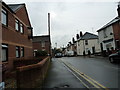
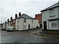
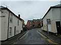
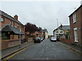
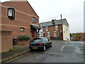
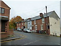
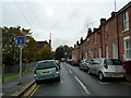
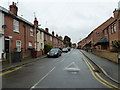
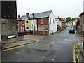
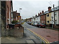
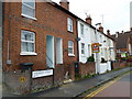
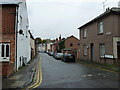
100 photos from this area
Area Information
Key information about the RG1 2SA including its size, population, and administrative classification.
- Area Type
- Postcode
- Area Size
- 5584 m²
- Population
- 1360
- Population Density
- 10915 people/km²
House Prices in RG1 2SA
48
Properties
£166,431
Average Sold Price
£53,000
Lowest Price
£275,000
Highest Price
Showing 48 properties
| Address | Type | Beds | Baths | Last Sale Price | Last Sale Date | |
|---|---|---|---|---|---|---|
| 22 St Giles Close, Reading, RG1 2SA | Flat | - | - | £275,000 | Jun 2020 | |
| 28 St Giles Close, Reading, RG1 2SA | Flat | - | - | £250,000 | Dec 2015 | |
| 14 St Giles Close, Reading, RG1 2SA | Terraced | 2 | 1 | £226,000 | Dec 2014 | |
| 30 St Giles Close, Reading, RG1 2SA | Flat | - | - | £145,500 | May 2014 | |
| 10 St Giles Close, Reading, RG1 2SA | Terraced | - | - | £212,000 | Feb 2008 | |
| 43 St Giles Close, Reading, RG1 2SA | house | 2 | 1 | £109,950 | Oct 1999 | |
| 44 St Giles Close, Reading, RG1 2SA | Flat | - | - | £60,000 | Aug 1999 | |
| 21 St Giles Close, Reading, RG1 2SA | Flat | - | - | £53,000 | Apr 1997 | |
| Flat 3, Prince Regent House, St Giles Close, Reading, RG1 2SA | Flat | 2 | 1 | - | - | |
| Flat 1, Prince Regent House, St Giles Close, Reading, RG1 2SA | Flat | 2 | 1 | - | - |
Page 1 of 5
Energy Efficiency in RG1 2SA
Amenities
Schools
| Rank | School | Type | Entry gender | Ages |
|---|
Explore more schools in this area
Go to Schools tabDemographics
Household Size
One person
most common
Accommodation Type
Flats
most common
Tenure
26
majority
Ethnic Group
White
most common
Religion
N/A
most common
Household Composition
N/A
most common
Age
22
median
Adults (30-64 years)
most common
Household Deprivation
N/A
with no deprivation
NS-SEC
40
in Lower managerial occupations
Explore more demographic insights in this area
Go to Demographics tabPlanning
Planning Constraints
- Flood RiskPremium
- Ramsar Wetland SitesPremium
- Area of Outstanding Natural BeautyPremium
- Protected Nature ReservePremium
- Protected WoodlandPremium