Area Overview for RG1 1PB
Photos of RG1 1PB
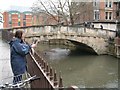
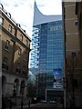
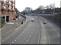
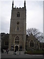
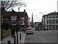
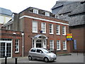
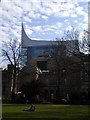
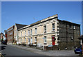
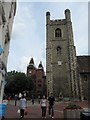
100 photos from this area
Area Information
Key information about the RG1 1PB including its size, population, and administrative classification.
- Area Type
- Postcode
- Area Size
- 3662 m²
- Population
- 2169
- Population Density
- 2814 people/km²
House Prices in RG1 1PB
19
Properties
£245,158
Average Sold Price
£54,000
Lowest Price
£475,000
Highest Price
Showing 19 properties
| Address | Type | Beds | Baths | Last Sale Price | Last Sale Date | |
|---|---|---|---|---|---|---|
| 8 Stanshawe Road, Reading, RG1 1PB | Terraced | 5 | 3 | £430,000 | Jul 2025 | |
| 24 Stanshawe Road, Reading, RG1 1PB | Terraced | 2 | 1 | £395,000 | Feb 2023 | |
| 28 Stanshawe Road, Reading, RG1 1PB | Terraced | 3 | 2 | £475,000 | Jan 2023 | |
| 22 Stanshawe Road, Reading, RG1 1PB | Terraced | 3 | 1 | £313,000 | May 2022 | |
| 9 Stanshawe Road, Reading, RG1 1PB | Maisonette | 2 | 1 | £244,500 | Nov 2018 | |
| 26 Stanshawe Road, Reading, RG1 1PB | Terraced | 3 | 1 | £232,500 | Feb 2015 | |
| 12 Stanshawe Road, Reading, RG1 1PB | house | 4 | - | £200,000 | Sep 2010 | |
| 13 Stanshawe Road, Reading, RG1 1PB | house | - | - | £212,000 | Nov 2006 | |
| 20 Stanshawe Road, Reading, RG1 1PB | Terraced | 3 | 2 | £165,950 | Aug 2005 | |
| 16 Stanshawe Road, Reading, RG1 1PB | house | - | - | £54,000 | Jun 2002 |
Page 1 of 2
Energy Efficiency in RG1 1PB
Amenities
Schools
| Rank | School | Type | Entry gender | Ages |
|---|
Explore more schools in this area
Go to Schools tabDemographics
Household Size
One person
most common
Accommodation Type
Flats
most common
Tenure
19
majority
Ethnic Group
White
most common
Religion
N/A
most common
Household Composition
N/A
most common
Age
47
median
Adults (30-64 years)
most common
Household Deprivation
N/A
with no deprivation
NS-SEC
50
in Lower managerial occupations
Explore more demographic insights in this area
Go to Demographics tabPlanning
Planning Constraints
- Flood RiskPremium
- Ramsar Wetland SitesPremium
- Area of Outstanding Natural BeautyPremium
- Protected Nature ReservePremium
- Protected WoodlandPremium